Navigation map page, Hazard avoidance – Garmin G1000 Mooney M20TN User Manual
Page 274
Garmin G1000 Pilot’s Guide for the Mooney M20M/M20R/M20TN
190-00647-00 Rev. A
6-38
HAZARD AVOIDANCE
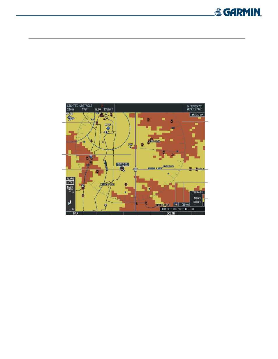
NAVIGATION MAP PAGE
Terrain and obstacle data can be displayed on the Navigation Map Page (Figure 6-46). Obstacles are shown
on the Navigation Map Page at or below the map range of 50 nm. To display information about an obstacle
(Figure 6-46), press the Joystick and move the panning arrow over the obstacle icon. Press the ENT
key.
Displaying Terrain Proximity data on the Navigation Map Page:
1)
Press the MAP Softkey.
2)
Press the TERRAIN Softkey to display the terrain and obstacle data on the Navigation Map Page.
Panning
Arrow Placed
on Lighted
Obstacle
Aircraft Symbol
Yellow Terrain
Area (Between
100’ and 1000’
Below Aircraft
Altitude)
Terrain Legend
Terrain Symbol
and Range
Red Lighted
Obstacles
(Above or
Within 100’
Below Aircraft
Altitude)
Red Terrain
Area (Above
or Within
100’ Below
Aircraft
Altitude)
Figure 6-46 Terrain Information on the Navigation Map Page