Xm wx satellite weather on the navigation map, Hazard avoidance, Setting up the navigation map page – Garmin G1000 Mooney M20TN User Manual
Page 262
Garmin G1000 Pilot’s Guide for the Mooney M20M/M20R/M20TN
190-00647-00 Rev. A
6-26
HAZARD AVOIDANCE
XM WX SATELLITE WEATHER ON THE NAVIGATION MAP
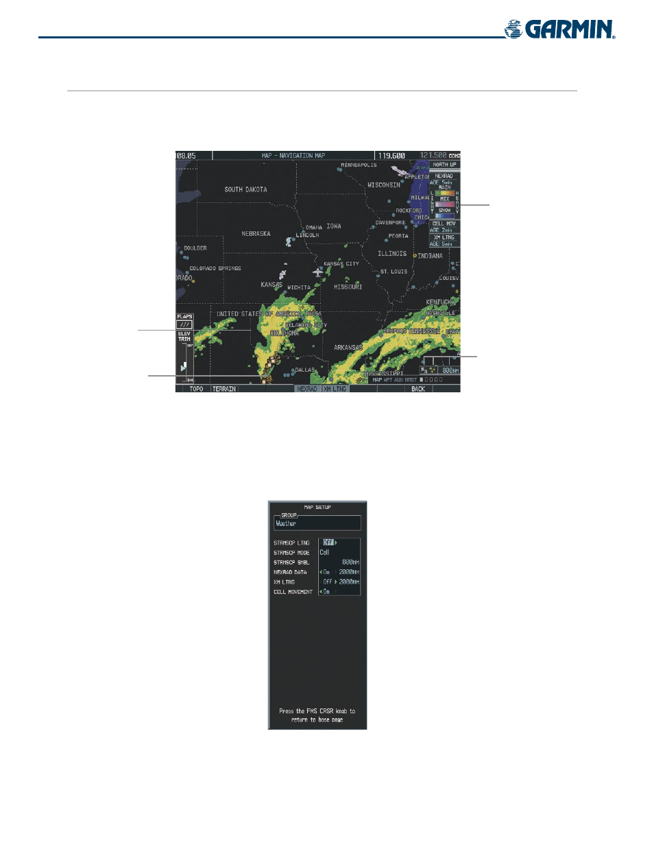
When appropriately configured, the Navigation Map displays NEXRAD, Cell Movement, TFRs, and XM
Lightning data as shown in Figure 6-35. This improves situational awareness and makes it easier to relate
storm activity to airports, NAVAIDS, obstacles, and other ground references.
Figure 6-35 Navigation Map Page Displaying NEXRAD Weather
NEXRAD
Weather
NEXRAD
Products, Storm
Legend, and Age
NEXRAD and XM
Lightning Icons, 800
nm Range
Cell Movement
Indication
SETTING UP THE NAVIGATION MAP PAGE
Use the Map Setup Window (Figure 6-36) to customize the display of weather data on the Navigation Map
Page. The Map Setup Window settings control the display of weather data on all G1000 pages except the
Weather Data Link Page.
Figure 6-36 Map Setup Window