Displaying terrain proximity data, Hazard avoidance – Garmin G1000 Mooney M20TN User Manual
Page 270
Garmin G1000 Pilot’s Guide for the Mooney M20M/M20R/M20TN
190-00647-00 Rev. A
6-34
HAZARD AVOIDANCE
�������
�����������������
�����������������
��������������������������������
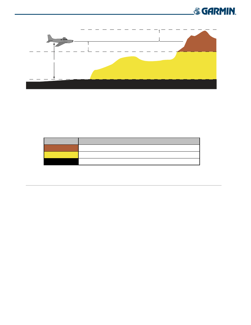
Figure 6-43 Terrain Proximity Indications and Colors
In Figure 6-43, terrain elevation is shown relative to the aircraft altitude. Obstacle colors are displayed in Table
6-5. Terrain and obstacles that are above the aircraft or less than 100 feet below the aircraft altitude are shown
in red. Those between 100 feet and 1000 feet below the aircraft altitude are shown in yellow. Terrain lower than
1000 feet below the aircraft altitude is shown in black. Obstacle data is displayed in gray when the difference in
aircraft altitude and obstacle height is greater than 1000 feet.
Terrain Color
Terrain Location
Red
Terrain above or within 100 ft below the aircraft altitude
Yellow
Terrain between 100 ft and 1000 ft below the aircraft altitude
Black
Terrain more than 1000 ft below the aircraft altitude
Table 6-5 Terrain Proximity Colors
DISPLAYING TERRAIN PROXIMITY DATA
Terrain and obstacle information can be displayed on the following pages:
• Terrain Proximity Page
• AUX - Trip Planning Page
• Navigation Map
• Flight Plan Pages (except VNAV)
• PFD Inset Map
To display terrain and obstacle data on any page other than the Terrain Proximity Page, press the MAP
Softkey, then press the TERRAIN Softkey. Obstacles with heights greater than 200 feet above ground level
(AGL) are displayed in three color levels (Table 6-6). The G1000 adjusts colors automatically as the aircraft
altitude changes.
Terrain Proximity may also be deselected from the Inset Map without affecting the terrain display on the MFD
maps.