5 terrain-svs, Hazard avoidance – Garmin G1000 Piper PA-46 Matrix User Manual
Page 374
Garmin G1000 Pilot’s Guide for the Piper PA-46 Mirage/Matrix
190-01108-00 Rev. B
360
HAZARD AVOIDANCE
SY
STEM
O
VER
VIEW
FLIGHT
INSTRUMENTS
EICAS
AUDIO P
ANEL
& CNS
FLIGHT
MANA
GEMENT
HAZARD
AV
OID
ANCE
AFCS
ADDITIONAL FEA
TURES
APPENDICES
INDEX
SY
STEM
O
VER
VIEW
FLIGHT
INSTRUMENTS
EICAS
AUDIO P
ANEL
& CNS
FLIGHT
MANA
GEMENT
HAZARD
AV
OID
ANCE
AFCS
ADDITIONAL FEA
TURES
APPENDICES
INDEX
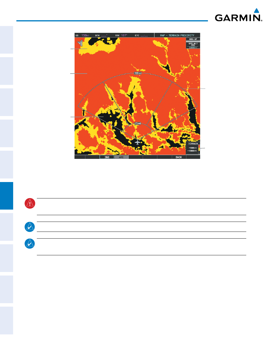
Figure 6-77 Terrain Proximity Page (ARC View)
Yellow Terrain
(Between 100’ and 1000’
Below the Aircraft Altitude)
Red Terrain
(Above or Within 100’
Below the Aircraft Altitude)
Black Terrain
(Terrain More than 1000’
Below the Aircraft Altitude)
Map Range Arcs
Terrain Legend
6.5 TERRAIN-SVS
WARNING:
Do not use TERRAIN-SVS information for primary terrain avoidance. TERRAIN-SVS is intended
only to enhance situational awareness.
NOTE:
Terrain data is not displayed when the aircraft latitude is greater than 75° North or 60° South.
NOTE:
TERRAIN-SVS is standard when the Synthetic Vision System (SVS) option is installed. The TAWS-B
option will take precedence over TERRAIN-SVS.
G1000 TERRAIN-SVS is a terrain awareness system available with the Synthetic Vision System (SVS). SVS
functionality is offered as an optional enhancement. Optional Terrain Awareness and Warning System - Class B
(TAWS-B) or standard TERRAIN-SVS is integrated within SVS to provide visual and auditory alerts to indicate the
presence of threatening terrain relevant to the projected flight path. For detailed information regarding SVS, refer
to the Synthetic Vision System (SVS) section of the G1000 Pilot’s Guide.
TERRAIN-SVS does not comply with TSO-C151b certification standards. It increases situational awareness
and aids in reducing controlled flight into terrain (CFIT). Do not confuse TERRAIN-SVS with TAWS-B. TAWS-B
is more sophisticated and robust, and it is TSO-C151b certified. Although the terrain and obstacle color map
displays are the same, TAWS-B uses more sophisticated algorithms to assess aircraft distance from terrain and
obstacles.