RLE LD5200 V.2.3 User Manual
Page 62
62
LD5200 User Guide
800.518.1519
4
Web Interface
Map Type
Only available on
Map 1
Distance Read - the traditional map overlay, use this option to plot
points and pinpoint a leak’s location with sensing cable.
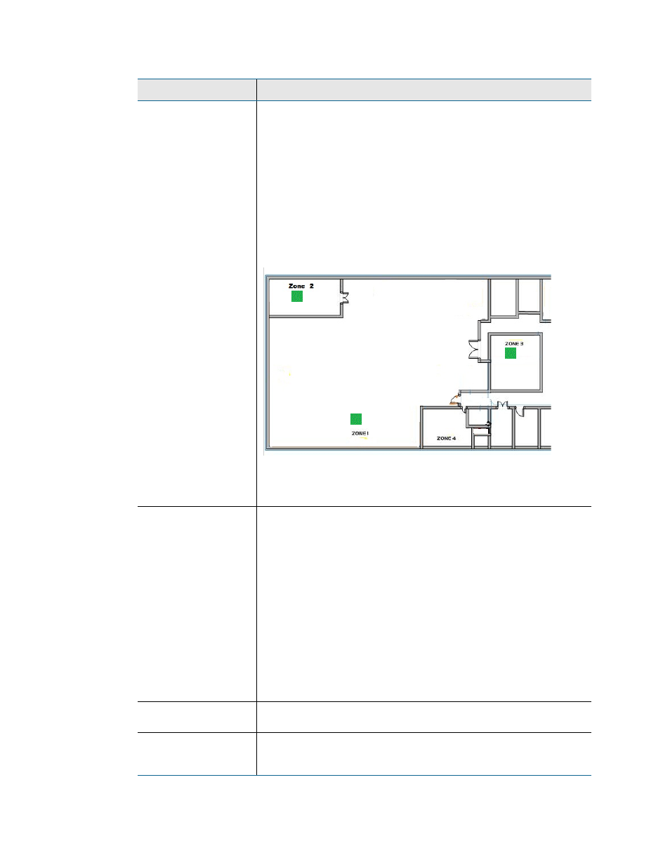
Master Zone Map - only available for map #1, this option allows
users to view the status of all of their configured physical zones
from one map.
If one of the zones reports an alarm condition, that condition will
appear as an appropriately colored box on the map. Zone 1 will
always represent the LD5200 you’re working with.
In this example, three zones are being monitored and no alarms are
present.
Default setting: Distance Read
Master Zone Map
Links
The zones (colored squares) on the Master Zone Map can be
configured as links. These links can either connect to a map of that
specific slave unit/zone, or can connect directly to the web interface
for the slave unit.
Disabled - No active links within the Master Zone Map.
Maps 2-10 - Link to preloaded image maps, which allows you to drill
down into a graphical overview of the individual units.
Slave Web Page - The LD5200 imports the links from the
information entered on the Slave Controller Configuration page.
This allows the links in the map to link directly to the web interfaces
(when available) for those slave units.
Default setting: Disabled
Zone/Controller
Designate the zone or controller with which this map corresponds.
Zone/Controller 1 is reserved for the LD5200 you’re working with.
Map Alarm
Coordinates - Text
Click this link to adjust the mapped points based on their numerical
coordinates. This is helpful if you wish to fine-tune mapped
coordinates.
Option
Description
Table 4.7
Map Settings Options