Triton Perspective User Manual
Page 4
iii |
P a g e
F e b r u a r y 2 0 1 1
MosaicOne™ makes the production of high quality
geo-registered sidescan mosaics a simple process.
Mosaic images of sidescan or multibeam backscatter
data are created by simply dragging and dropping raw
XTF data files into the Perspective Map multi-layer
map view. Processing options such as nadir delete,
far range clipping, and single-channel select, coupled
with a comprehensive set of navigation processing
tools, result in superior quality mosaics suited to specific application needs and collection
regimes. MosaicOne images are displayed in Perspective in correct registration with other
survey data such as shaded or color-coded bathymetry, electronic nautical charts, coastline
vector data, survey tracks, target icons, annotation, seabed classifications, etc. Data fusion is
facilitated by adjusting the transparency of mosaic images allowing visual comparison of
sidescan features with underlying data elements. Fine adjustments to line position are easily
made with the new Move Line feature and high-resolution waterfall displays of sidescan data
direct from source XTF files cab be invoked with point and click at any position on the
mosaic.
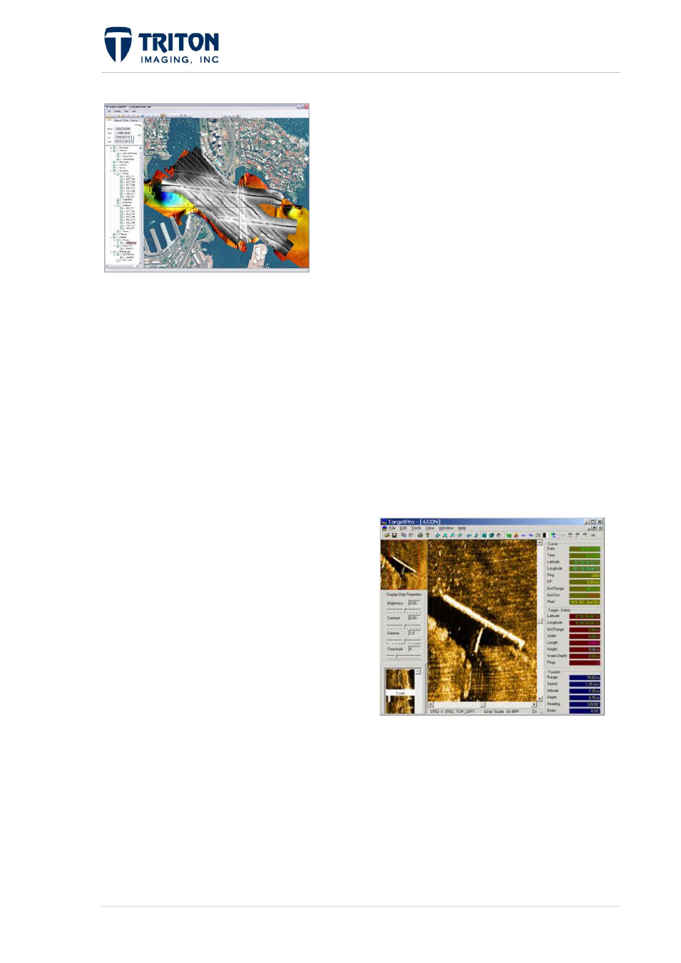
TargetOne™ is a collection of target
processing tools that enable the acquisition and
analysis of objects seen in the sidescan data.
Targets are acquired with point and click on a
sidescan mosaic displayed in Perspective Map
or from the raw sidescan data viewed in
Perspective's embedded waterfall viewer. The
TargetOne module displays target images and
provides for a variety of image manipulation
and measurement tools to facilitate object recognition and classification. Target positions are
recorded as icons displayed on the mosaic with easy access to any target by clicking on an
icon of interest. Object measurement tools are provided that exploit sonar parameters.
Output of target information is in standard XML format to support processing by other
applications.