Navig atio n, Map operation and map setting – Mercedes-Benz SLS-Class 2013 COMAND Manual User Manual
Page 109
Height display : and number of satellites
used ? are not displayed.
Display switched off
:
Current map orientation
While moving the map, you will see additional
data, e.g. road names, depending on the
crosshair position, if the digital map supports
this data (
Y
page 103).
Coordinates on the map
X
To show the menu: press W the COMAND
controller.
X
Select
Navi
Navi
in the main function bar by
sliding ZV and turning cVd the COMAND
controller and press W to confirm.
X
Select
Map Settings
Map Settings
and press W to
confirm.
The map settings menu appears.
X
Select
Compass On Map
Compass On Map
and press W to
confirm.
A menu appears.
X
Select
Never
Never
,
When Off-Road
When Off-Road
or
When
When
Route Guidance Inactive
Route Guidance Inactive
and press W
to confirm.
The selected setting is accepted.
Switching additional information on/
off
Switching the topographic map on/off
X
To show the menu: press W the COMAND
controller.
X
Select
Navi
Navi
in the main function bar by
sliding ZV and turning cVd the COMAND
controller and press W to confirm.
X
Select
Map Settings
Map Settings
and press W to
confirm.
The map settings menu appears.
X
Select
Topographic Map
Topographic Map
and press W to
confirm.
Depending on the previous status, switch
the option on O or off ª.
The topographical map uses different colors
to depict elevation. The color key generally
reflects the topography's dominant
vegetation or the ground's perceived color
when seen from the air, for example:
R
green (grass) for lowland
R
yellow, brown (woodland) for hills
R
gray (stone) and white (snow) for
mountains.
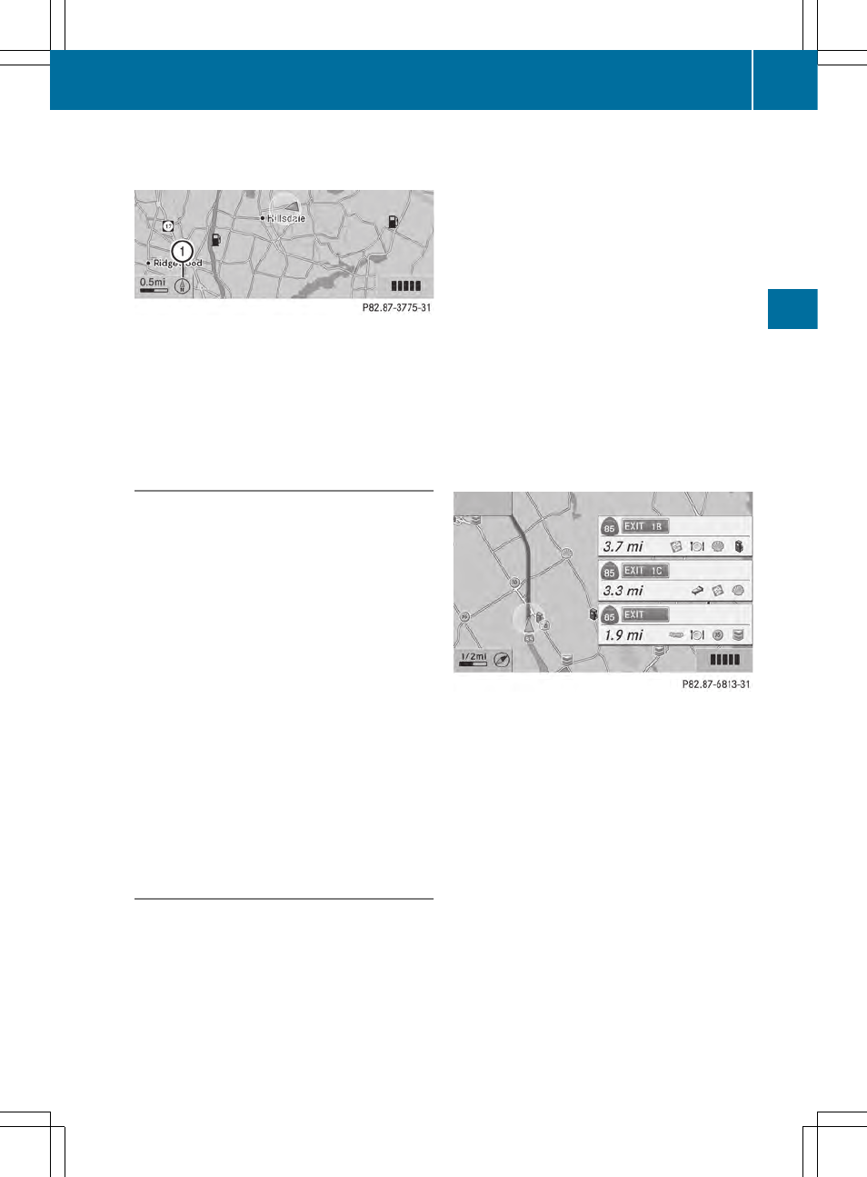
Example: highway information
Switching highway information on/off
When driving on the highway, you can see the
following information on the right of the
display:
R
the nearest gas stations
R
the nearest rest areas etc.
R
and their distance from the current vehicle
position
The entries show the number of the
highway and the highway exits as well as
their distance from the current vehicle
position.
X
To switch on navigation mode: press the
Ø function button.
Map operation and map setting
107
Navig
atio
n
Z
- SLK-Class 2013 COMAND Manual SL-Class 2013 COMAND Manual M-Class 2013 COMAND Manual GLK-Class 2013 COMAND Manual GL-Class 2013 COMAND Manual G-Class 2013 COMAND Manual E-Wagon 2013 COMAND Manual E-Sedan 2013 COMAND Manual E-Cab 2013 COMAND Manual E-Coupe 2013 COMAND Manual CLS-Class 2013 COMAND Manual C-Sedan 2013 COMAND Manual C-Coupe 2013 COMAND Manual