Start gps survey - solve localization – Spectra Precision Survey Pro v4.5 Ranger User Manual User Manual
Page 256
User’s Manual – GPS Mode
246
3. Tap Next>.
4. Review the base reference position to be stored in Survey Pro.
Tap Set to accept the remote base receiver antenna and
position and update the raw data, and continue with the RTK
survey.
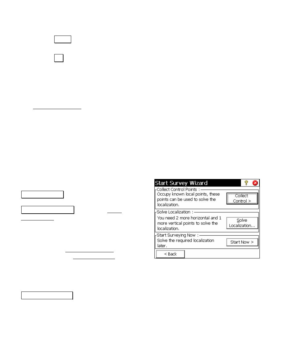
Start GPS Survey - Solve Localization
The Start GPS Survey Solve Localization screen is displayed when
you need a horizontal adjustment to solve your coordinate system. A
horizontal adjustment is required to solve your coordinate system any
time you begin a survey from an autonomous base position. This is
always the case when your projection mode is Ground – TDS
Localization
, since your first base setup is always from an autonomous
GPS position. This may be the case when your projection mode is
Mapping Plane
, when you set your first base on a new point. A vertical
adjustment is often desired, although not required before data
collection can begin.
The horizontal and vertical adjustments are
usually solved together. First, tap
Collect Control> to occupy some existing local
points as GPS Control points. Next, tap
Solve Localization … to open the Solve
Localization wizard to calculate the horizontal
and vertical adjustment parameters (Page
252).
After you successfully solve the localization
adjustment, the Start GPS Survey wizard will
close, and the GPS Data Collection screen will
open (Page 264). You are now ready to measure and store new points
in this job.
You can also choose to start the survey without solving the
localization, and complete the required adjustment later. Tap
Start Survey Now > to apply a temporary localization and begin data
collection. Any time during the survey, you can occupy the required
control points and solve the localization parameters. The GPS data
collected points will be updated to the proper local coordinate after
the localization is solved.