Triton TritonMap User Manual
Page 135
June 2004 DelphMap™ User's Manual
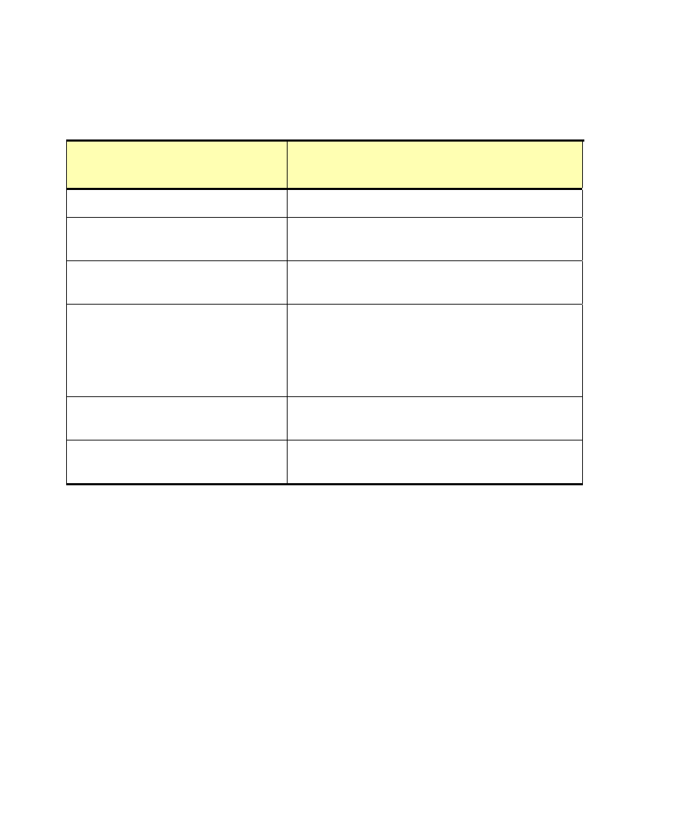
TABLE 4.
Arrangement of a world file’s data
Typical World
File’s Contents
Meaning of the Contents
12.34567890123456 the
x-scale vector size of a pixel, in map units
0.00000000000000
the amount of rotation for a row (that is, along the
x-scale)
0.00000000000000
the amount of rotation for a column (that is, along
the y-scale)
-12.34567890123456 the
y-scale vector size of a pixel, in map units;
this is the negative value of the pixel’s x-scale
vector size, so that any differences between
image and non-image origins can be
distinguished.
987654.98765432101234 the
x coordinate, in map units, of the center of
the upper left pixel
9876543.98765432101234 the
y coordinate, in map units, of the center of
the upper left pixel
Note: Software capable of reading a world file always expects to read data in
the order of the values are shown in Table 4.
To get an image’s geo-coordinates from DelphMap
• Click Project→Project Information...
DelphMap displays a dialog box containing the coordinate information.
An example appears in Figure 59.
Chapter 8: TIFF and GeoTIFF Differences
121