Working with the grid manager – Pitney Bowes MapInfo Vertical Mapper User Manual
Page 93
Chapter 6: Working with Grids
User Guide
91
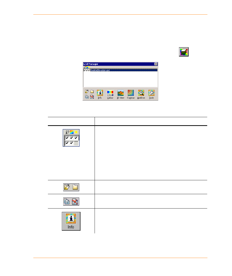
Working with the Grid Manager
The Grid Manager enables you to obtain information about grid files, access the Grid Colour tool or
the Dictionary Editor, run the 3D Viewer, create a 3D drape file, create region and polyline contours,
and analyze or modify your grid files.
•
On the Vertical Mapper Project toolbar, click the Show Grid Manager button
.
Note You can also open the Grid Manager by choosing the Show Grid Manager command from
the Vertical Mapper menu.
Grid Manager Options
Description
Three check boxes are displayed next to the grid name.
By enabling the Active check box you can make a grid active and
query it using the Grid Info tool.
By clearing the Colour Gradient check box, you can turn off the
colour profile for a grid and display it in grey-scale if relief shading
has been applied.
By enabling the Relief Shading check box, you can turn on the relief
shading function if it has been previously generated for the numeric
grid using the Grid Colour tool.
The Open Grid and Close Grid buttons enable you to open or close
grid files.
The Copy Grid As and Delete buttons enable you to copy or delete
grid files.
The Grid Info button expands the grid manager to provide
information on a selected grid in terms of geographic characteristics,
z-units, meta data, legend, and histogram.