Using the viewshed function, Exploring the viewshed dialog box, 137 using the viewshed function – Pitney Bowes MapInfo Vertical Mapper User Manual
Page 139
Chapter 7: Using Grids for Spatial Analysis
User Guide
137
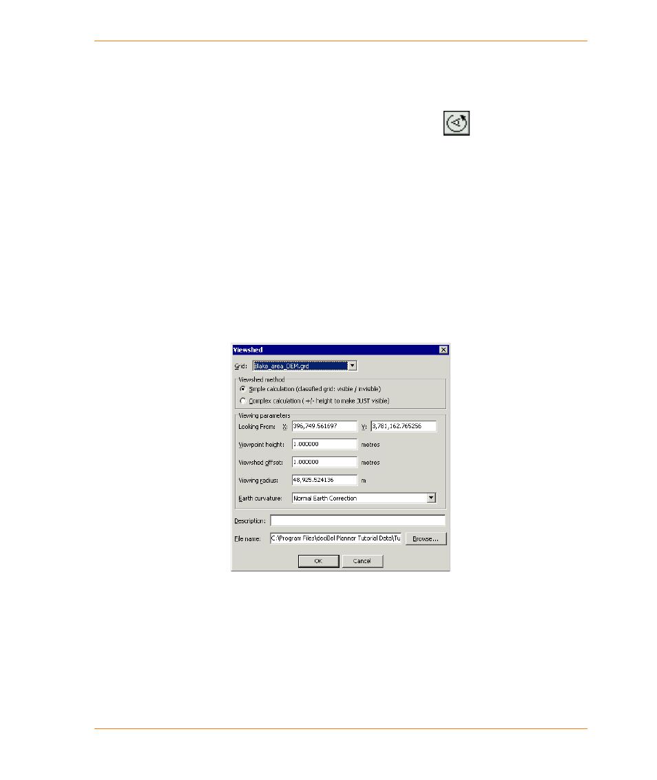
Using the Viewshed Function
The Viewshed function is appropriate only for use on a grid file that has a unit of elevation (feet or
metres) as its z-value.
1. On the Vertical Mapper toolbar, click the Viewpoint Pick button.
2. Using the left mouse button, choose a point in the Map window of the open elevation grid file that
represents the point of origin for the viewshed calculation.
3. In the Viewshed dialog box, enter the required parameters in the appropriate boxes and click the
OK button.
Note You can also access the Viewshed tool from the Grid Manager. Click the Analysis button,
and choose the Viewshed Analysis command. You can use this method to do a multi-
point viewshed analysis. For more information on multi-point viewshed analysis, see
Performing Multipoint Viewshed Analysis on page 138
Exploring the Viewshed Dialog Box
The Viewshed dialog box enables you to set a number of viewshed parameters that control the
calculation.
The Grid list enables you to select the appropriate grid file for analysis if such selection is not made
in the Grid Manager.
The Viewshed Parameters section enables you to calculate the visibility values assigned to each
cell in the new Viewshed grid in two ways: