The viewshed function – Pitney Bowes MapInfo Vertical Mapper User Manual
Page 138
The Viewshed Function
136
Vertical Mapper 3.7
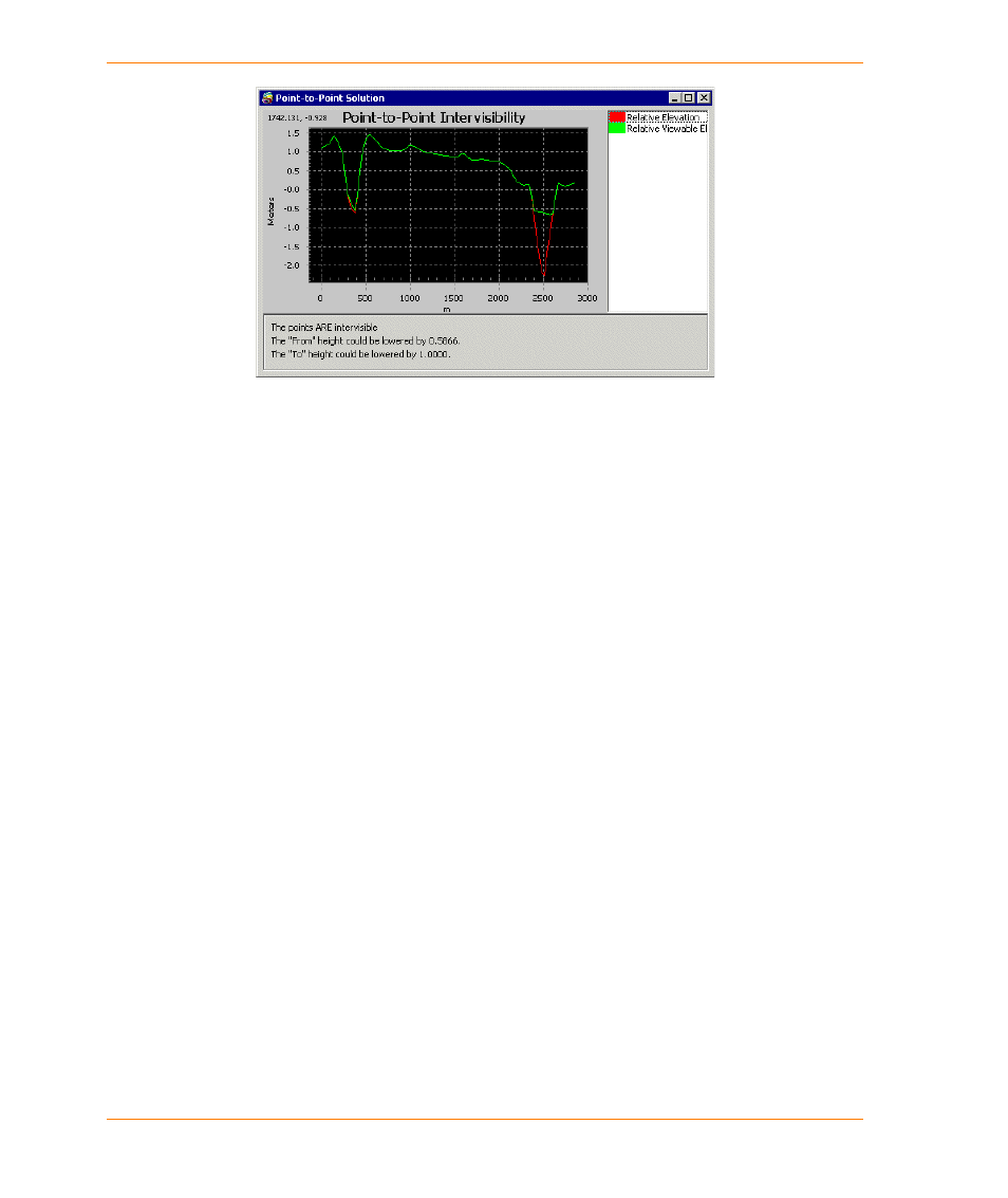
The relative elevation indicated by the red line represents the surface topography along the line of
sight, while the relative viewable elevation (green) represents the line of visibility. Where the two
lines are coincident, that section of topography is visible from the “From” point.
Immediately below the graph is a written description of the relationship between the “From” and “To”
points of the line of sight path. If the two end points of the line are intervisible, the dialog box will
report how the “From” and “To” heights could be adjusted and still remain visible. If the line end
points are not intervisible, the dialog box will report the corrections necessary to produce
intervisibility.
The Solve button enables you to initiate a new calculation every time a different line of sight path is
constructed using the Point-to-Point tool.
The Viewshed Function
Viewshed is defined as a delineation process identifying all locations on a grid that are visually
connected (visible in a direct line-of-sight) to a single observation point.
The Viewshed function computes visibility between one or more observation points (the viewpoints)
and each of the cells in an elevation grid file (the destination cells) in one of two ways: as a simple
visible/invisible answer for each of the destination cells; or as a computed value representing the
height that each destination cell should be raised or lowered to make it just visible from the
viewpoint.
In other words, if a destination cell is not visible from the viewpoint, then a negative value is returned
specifying the height below the line of sight. To become just visible this height has to be added to the
destination cell. If the destination cell is visible, then a positive value is returned specifying the height
above the line of sight. The viewpoint can be lowered by this height and remain just visible.
The Viewshed function is designed to work with the Viewpoint Pick tool found on the Vertical Mapper
toolbar. You can use the tool to identify the view point from which intervisibility for an entire elevation
grid file is calculated or you can use it to select an existing point present in the Map window.