Inverse distance weighting interpolation – Pitney Bowes MapInfo Vertical Mapper User Manual
Page 35
Chapter 3: Creating Grids Using Interpolation
User Guide
33
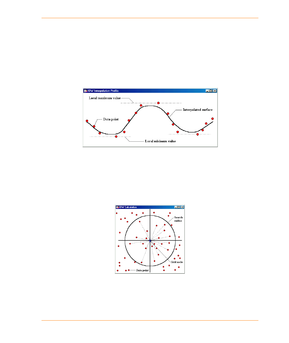
Inverse Distance Weighting Interpolation
Inverse Distance Weighting (IDW) interpolation is a moving average interpolation technique that is
usually applied to highly variable data. For certain data types, it is possible to return to the collection
site and record a new value that is statistically different from the original reading but within the
general trend for the area.
Examples of this type of data include environmental monitoring data such as soil chemistry and
consumer behaviour observations. It is not desirable to honour local high/low values but rather to
look at a moving average of nearby data points and estimate the local trends.
The interpolated surface, estimated by using a moving average technique, is less than
the local maximum value and greater than the local minimum value.
The IDW technique calculates a value for each grid node by examining surrounding data points that
lie within a user-defined search radius. Some or all of the data points can be used in the interpolation
process. The node value is calculated by averaging the weighted sum of all the points. Data points
that lie progressively farther from the node influence the computed value far less than those lying
closer to the node.
A radius is generated around each grid node from which data points are selected for
use in the calculation.