Custom point estimation, Exploring the custom point estimation dialog box – Pitney Bowes MapInfo Vertical Mapper User Manual
Page 53
Chapter 3: Creating Grids Using Interpolation
User Guide
51
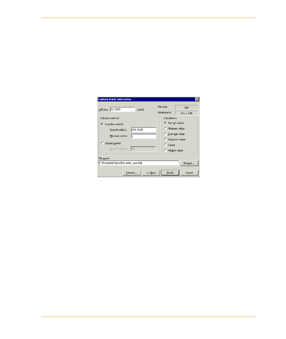
Custom Point Estimation
The Custom Point Estimation technique is similar to the IDW (Inverse Distance Weighting)
technique, in which grid values are calculated based upon the points found within a predefined
search radius. The main difference between these two techniques is that using the Custom Point
Estimation technique, you can choose from six different calculations to perform on data points.
Exploring the Custom Point Estimation Dialog Box
The Custom Point Estimation dialog box enables you to specify parameters that are specific to the
point estimation calculation.
The Cell Size box enables you to specify the cell size in the coordinate unit of the point file to be
processed.
The Search Radius box enables you to specify the size of a radius land area in which points are to
be calculated for.
The Solution Method section contains the following options.
•
The In-Radius Search option enables you to define the search radius and the minimum number
of points within the search radius. If the number of points found is less than the minimum value
as defined, a null value is returned.
•
The Closest Points option enables you to define the number of closest points that are included
in the calculation.
The Calculation section contains the following options:
•
The Sum of Values option returns the sum of the values of all the points within the search area
or within the number of selected points.
•
The Minimum Value option returns the lowest value of all the points within the search area or
within the number of selected points.
•
The Average Value option returns the average value calculated by averaging all valid points
found within the search area or within the number of selected points.
•
The Maximum Value option returns the highest value of all the points within the search area or
within the number of selected points.