The point-to-point visibility function, Using the point-to-point visibility function, Exploring the point-to-point visibility dialog box – Pitney Bowes MapInfo Vertical Mapper User Manual
Page 135: The point-to-point visibility
Chapter 7: Using Grids for Spatial Analysis
User Guide
133
The Point-to-Point Visibility Function
Intervisibility and viewpoint analysis uses elevation grid files to determine visual exposure
relationships within a map area. Intervisibility is defined as the ability to see in a direct line of sight
from one position on the earth’s surface to another, considering the intervening terrain.
The Point-to-Point Visibility function enables you to specify a line across an elevation grid file (i.e.,
digital elevation model) for the calculation of intervisibility. The calculation returns an answer that is
both simple in response: “the two points ARE/ARE NOT intervisible”, and more complex: “this is the
height that one of the two points would have to be raised to become visible”, or “this is the height that
one of the two points would have to be lowered to become visible”.
Using the Point-to-Point Visibility Function
The Point-to-Point Visibility function enables you either to select a line-of-sight path from an existing
line object in a Map window or to draw the line-of-sight path directly in the Map window. You can use
this function only on a numeric grid that has a z-unit type of feet or metres.
1. On the Vertical Mapper toolbar, click the Point-to-Point Visibility button .
2. With the left mouse button held down, draw the line-of-sight path in the Map window of the open
elevation grid file, where the line direction corresponds to the direction of sight, that is, the
“looking from” position is the start of the line.
3. In the Viewing Parameters section of the Point-to-Point Visibility dialog box, choose all of the
parameters that will be calculated for each region and written into the region table.
4. Click the Solve button.
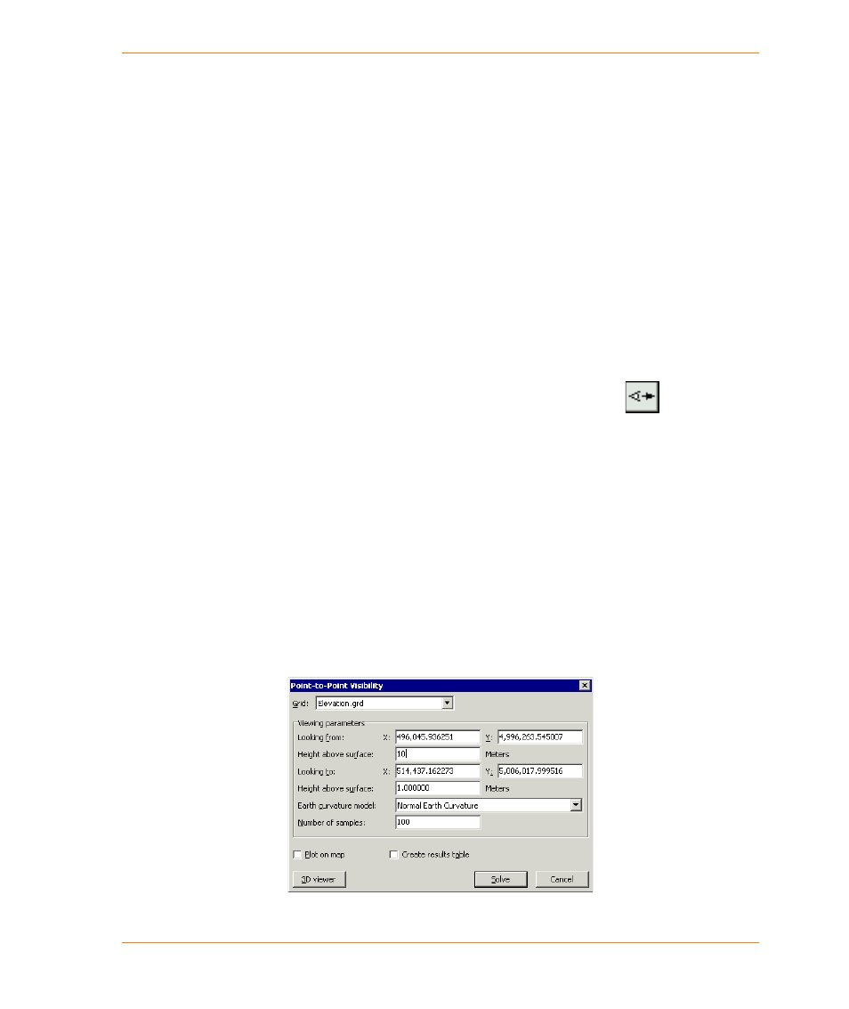
Exploring the Point-to-Point Visibility Dialog Box
The Point-to-Point Visibility function is appropriate for use on a grid file which has a unit of elevation
(feet or metres) as its z-value. If the Viewshed command encounters a grid file where the unit type is
not recognized as being a unit of elevation measurement, a warning appears, and you will be unable
to proceed with the command.