Exploring the grid import dialog box, 73 exploring the grid import dialog box – Pitney Bowes MapInfo Vertical Mapper User Manual
Page 75
Chapter 5: Creating Grids Using Other Methods
User Guide
73
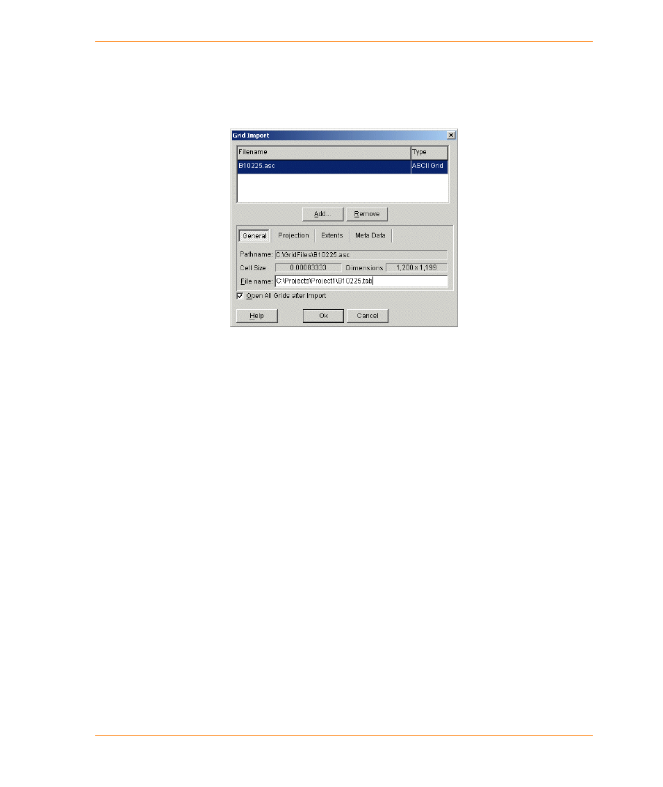
Exploring the Grid Import Dialog Box
The top section of the Grid Import dialog box lists all the files you have chosen as well as the
associated file formats. The bottom section presents four tabs containing information about the
highlighted grid.
The Add and Remove buttons enable you to add or remove files from the Import Files list. When
you choose a file and add it to the list, the Grid Import utility attempts to identify the file type that will
be displayed next to the file name in the list.
The General tab enables you to identify the full path name of the import file, the cell size, and the
estimated dimensions of the new grid file.
The Projection tab enables you to identify the coordinate system string that will be used. You can
re-select your projection prior to import if required.
The Extents tab provides information concerning the bounding area of the new grid.
The Meta Data tab enables you to enter a description (up to 31 characters) for the grid. If the import
file does not contain a z-unit description, you will be prompted on opening the file for import to
choose an appropriate z-unit. You may change it at any point until you click the OK button. The null
data value is a special value that will be used to indicate “no data”. If this value is not provided by the
import file, you will be prompted to enter it.
The Open All Grids after Import check box enables you to open all imported files after they have
been imported.