The view menu, The help menu, Making 3d drape files – Pitney Bowes MapInfo Vertical Mapper User Manual
Page 205: The view menu the help menu, Information, see
Chapter 12: Creating 3D Views Using GridView
User Guide
203
The Open/Save Workspace command opens an existing workspace or saves the current rendered
scene to a workspace. When you save a workspace, all the settings for recreating the rendered
scene are saved to an ASCII text file with a .gvw extension.
The Print/Print Set Up command controls how the rendered scene is printed and enables you to
select an installed printer.
The View Menu
The Scene Properties command opens the Scene Properties dialog box so you can make further
modifications. You can also open this dialog box by right-clicking anywhere within the rendered
GridView scene.
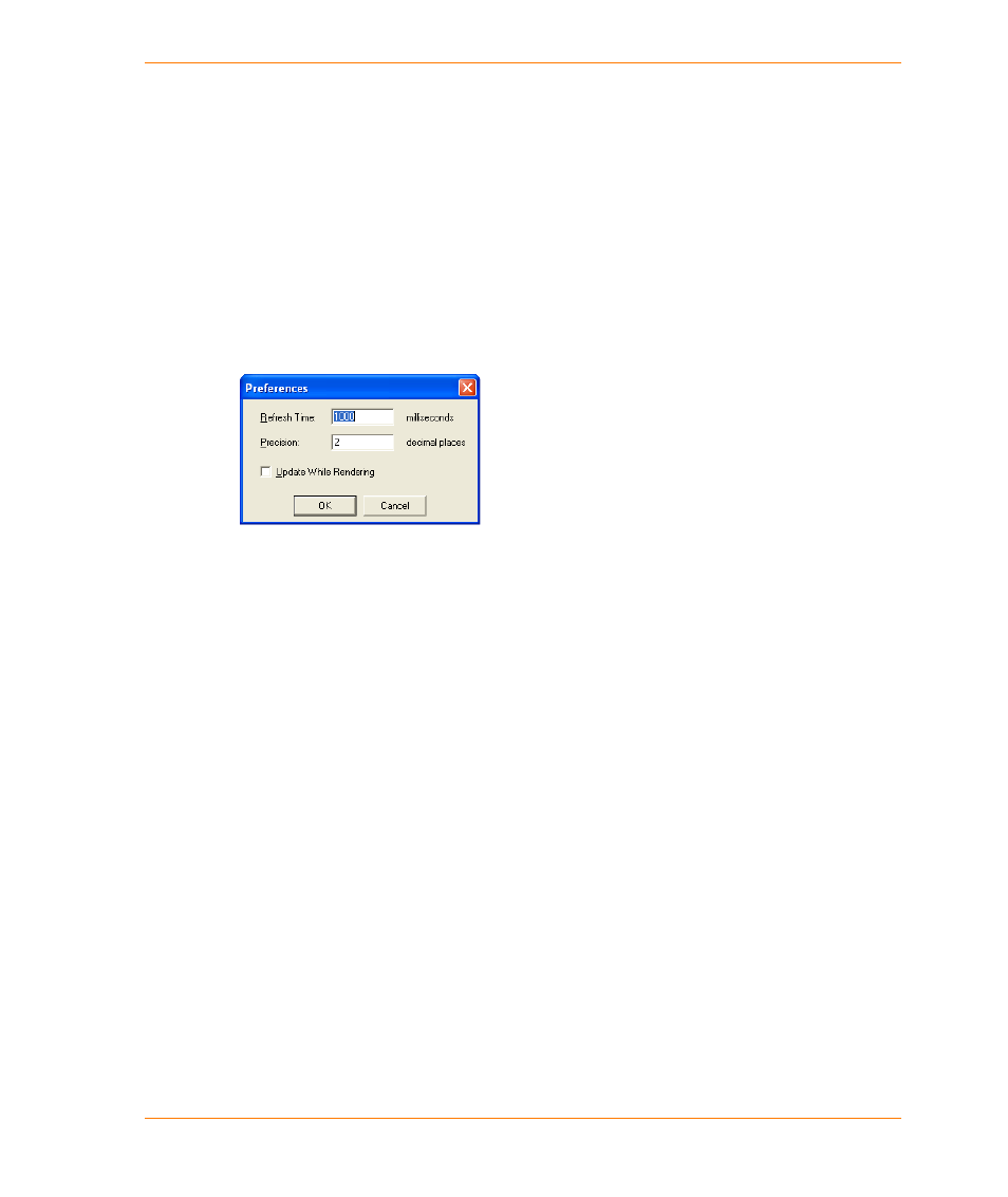
The Preferences command opens the 3D Viewer: Application Properties dialog box.
Set the following values:
•
The Refresh Time box enables you to set the length of the delay (in milliseconds) between
the time a setting is changed in the Scene Properties dialog box and the time when the
Preview window is refreshed.
•
The Preference Precision box enables you to specify the number of decimals that will be
displayed in the Scene Properties dialog box.
•
The Update While Rendering check box when this option is enabled, the scene is drawn to
the screen gradually as it is being rendered.
The Help Menu
You can access GridView help by clicking the Help Topics command from the Help menu.
Making 3D Drape Files
The process of draping involves combining georeferenced map objects with gridded data to create
3D perspective views of the area defined by the grid. Typically, the gridded information represents
elevation; however, it can represent numeric data. In GridView, acceptable georeferenced map
entities include symbols, lines, regions, text and other raster images such as air photos. Essentially
any map attribute that can be displayed in a MapInfo Map window can be included in a drape. If you
want to drape other raster images, you should orthorectify the images in the same projection system
as the grid they will be draped on.
GridView drape files are created in MapInfo Professional with the help of Vertical Mapper. Three
requirements must be met before you can create a drape: