Calculating the region area – Pitney Bowes MapInfo Vertical Mapper User Manual
Page 190
Calculating the Region Area
188
Vertical Mapper 3.7
The Select Region From Map check box—enables you to use a pre-defined MapInfo region as the
Voronoi boundary.
The Set Region Style button—enables you to customize the fill and line style pattern of the Voronoi
diagram.
Calculating the Region Area
The calculate region area command provides a quick way of seeing how densely packed points are.
It adds a column to the original data set specifying the area of the Voronoi region of each point. The
closer together points are, the smaller the area of the Voronoi region will be.
1. From the Vertical Mapper menu, choose the Natural Neighbour Analysis > Calculate Region
Area command.
2. In the Region Area dialog box, choose the appropriate table of points that contains the data to be
processed in the Create From Table list and click the Next button.
3. Choose one of the following options from the Boundary Smoothness section:
•
Coarse
•
Medium
•
Fine
4. Choose one of the following options from the Hull Boundary Width section:
•
User Defined—enables you to enter a value in the Width box.
•
Select Region From Map—enables you to use the VM Picker tool to choose the hull
boundary.
5. Click the Finish button.
The region area is added as a column to the grid table and displayed in a new browser window.
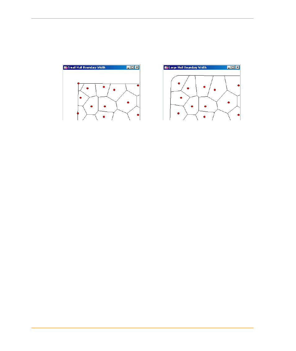
In this Voronoi diagram, the Hull Boundary
Margin width setting is very small (1). Therefore
polygons are effectively cut off at the outermost
limit of the point file.
For the same data, the Hull Boundary Margin
width has been set to 1 000, resulting in the
construction of outer polygon edges 1 000
metres away from the outermost points. The
rounded corners of the outer boundary are
controlled by the smoothness setting.