Airports, Rnwys tab, Airports -42 – BendixKing AV8OR Ace - Users Guide User Manual
Page 86: Rnwys tab -42, Figure 2-34: airport – more info -42
Honeywell Bendix/King AV8OR Ace User’s Guide
Aviation Mode Operation
D200904000003
Page 2-42
Rev 3 Mar 2012
©
Honeywell International Inc. Do not copy without express permission of Honeywell
The aircraft or helicopter symbol on the chart shows the actual
aircraft position (geo-referenced) and will change position as the
aircraft changes position.
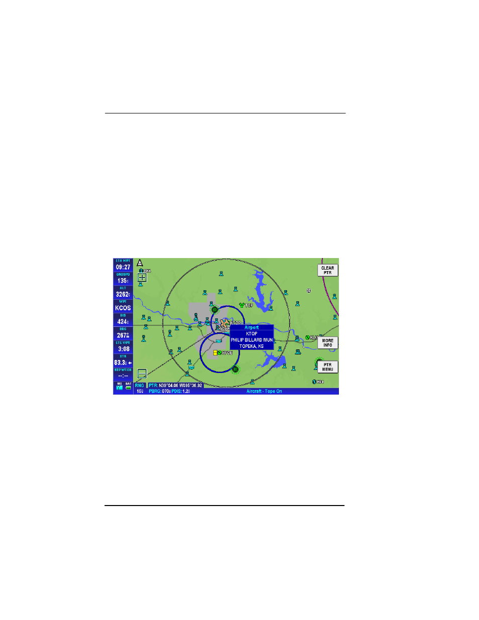
AIRPORTS
Airports show on the MAP page as blue or green circles with a line
drawn through them. The line indicates the direction of the primary
runway at the airport. Blue circles represent VFR airports and green
circles represent IFR airports.
Tap on an airport icon to bring up the
MORE INFO
soft key.
Shortcut: If an airport IDENT is already displayed in the WPT or the
DEST WPT Data Window, you can double tap on the Data Window
and the MORE INFO page for the selected airport will pop up.
Figure 2-34: Airport – MORE INFO
Rnwys Tab
Tap on the
MORE INFO
soft key to display the Airport Information –
Runways page as shown below.