Figure 2-30: map – relative terrain -37, Table 2-5 relative terrain -37 – BendixKing AV8OR Ace - Users Guide User Manual
Page 81
Honeywell Bendix/King AV8OR Ace User’s Guide
D200904000003
Aviation Mode Operation
Rev 3 Mar 2012
Page 2-37
©
Honeywell International Inc. Do not copy without express permission of Honeywell
Tapping the
MAP SETUP
soft key allows the user to configure the
Map Setup options. For more detail information about Map Setup,
refer to the Map Setup section on page 2-185 in the System Setup
section.
•
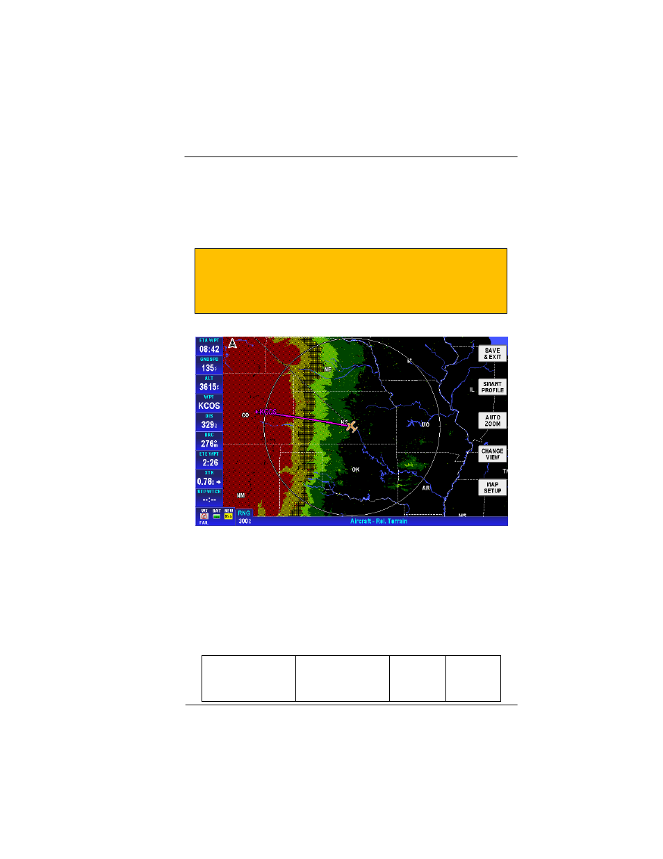
Relative Terrain
CAUTION
NEVER USE THE TOPOGRAPHIC ELEVATION
DISPLAYED ON THIS EQUIPMENT AS YOUR SOLE
REFERENCE FOR TERRAIN AVOIDANCE.
Figure 2-30: Map – Relative Terrain
o
On the Relative Terrain map, the terrain is colored
according to its height relative to the aircraft, as
shown in the following table.
o
A 0.5 nm radius circle around each is colored
according to the height of the obstacle relative to the
aircraft, as shown in the following table.
Table 2-5 Relative Terrain
Relative Terrain
Altitude (feet)
Relative
Obstacle
Color
Dither
Pattern
Percent