BendixKing AV8OR Ace - Users Guide User Manual
Page 59
Honeywell Bendix/King AV8OR Ace User’s Guide
D200904000003
Aviation Mode Operation
Rev 3 Mar 2012
Page 2-15
©
Honeywell International Inc. Do not copy without express permission of Honeywell
Fast Access (6):
Touch your finger in the fast access area and slide
it left or right to rapidly change pages between the configured
primary information pages (Map, Weather or Traffic) or rapidly
access the Map page. Refer to the Fast Access section on page 2-
16 below for more information.
Title Bar (7):
The title bar shows the currently selected map view
across the bottom of the Map page. The Title Bar area also provides
fast access to primary pages. For more information on how fast
access works, refer to the Fast Access section on page 2-16.
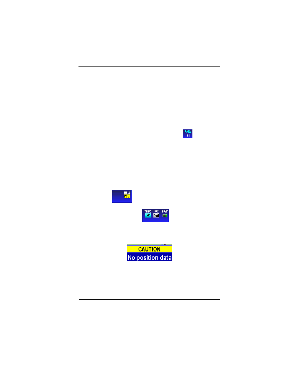
Map Range (8)
: The current range (labeled
RNG
) is displayed
in the range tag window in the lower left corner of the display. The
range distance unit (nautical miles, statute miles or kilometers) is
configured in the System Setup-GENERAL SYSTEM SETUP page.
Range is measured on the map as the distance from the center of
the aircraft symbol to the outer ring around the aircraft. The inner
ring is at one-half the displayed range value. These rings are turned
on or off in the System Setup section on the MAP SETUP page.
Status window (9)
: When there is a new aircraft status, a flashing
icon is displayed in the status window in the left bottom of the data
window column
. The status window also shows the battery
condition and the status of the XM weather receiver (if installed) and
traffic information (if installed).
.
Caution
: When AV8OR ACE has lost its GPS position fix, a blue “
No
position data
” caution message is displayed across the screen and
the aircraft symbol is not displayed.
If no altitude data is available and the map display option is set
to Relative Terrain Map, then a “
No Altitude Available
”
message is displayed.