Displaying traffic data, Displaying traffic data, Hazard avoidance – Garmin G1000 Quest Kodiak User Manual
Page 274
Garmin G1000 Pilot’s Guide for the Quest Kodiak 100
190-00590-00 Rev. C
6-42
HAZARD AVOIDANCE
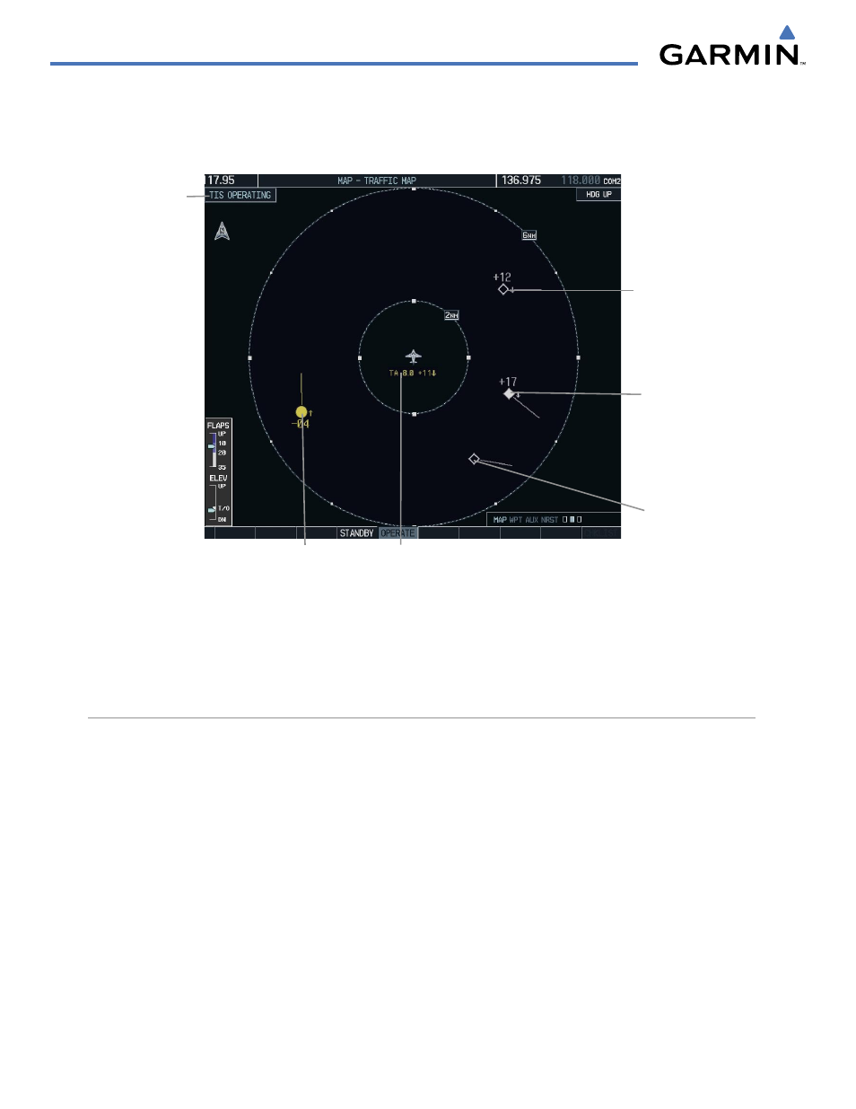
Altitude trend is displayed as an up or down arrow (±500 fpm in either direction) to the right of the target
symbol. If the altitude trend is less than 500 fpm in either direction, no arrow displays. TIS also provides a
vector line showing the direction in which the traffic is moving, to the nearest 45°.
Figure 6-47 Traffic Map Page - Advisories
Non-Threat
Traffic
Non-Threat
Traffic
Proximity Advisory,
Aircraft is 1700’
Above and
Descending - Moving
in the Direction of
the Vector Line
Traffic Advisory,
Aircraft is 400’
Below and Climbing
“Non-Bearing” Traffic (System is Unable
to Determine Bearing), Aircraft Distance
is 8.0 nm, 1100’ Above and Descending
Operating
Mode
TIS also displays non-bearing traffic, or traffic for which it is unable to determine the bearing. Non-bearing
traffic alert messages display in the center of the Traffic Map Page.
DISPLAYING TRAFFIC DATA
Traffic information can be displayed on the following pages:
• Traffic Map Page
• AUX - Trip Planning Page
• Navigation Map
• Nearest Pages
• WPT - VOR Information Page
• FPL - Active Flight Plan Page
• PFD Inset Map