System overview, Terrain, Strmscp (optional) – Garmin G1000 Quest Kodiak User Manual
Page 24: Nexrad (optional), Xm ltng (optional), Back, Alerts, Metric, Dflts, Brg1 (bearing)
SYSTEM OVERVIEW
1-14
190-00590-00 Rev. C
Garmin G1000 Pilot’s Guide for the Quest Kodiak 100
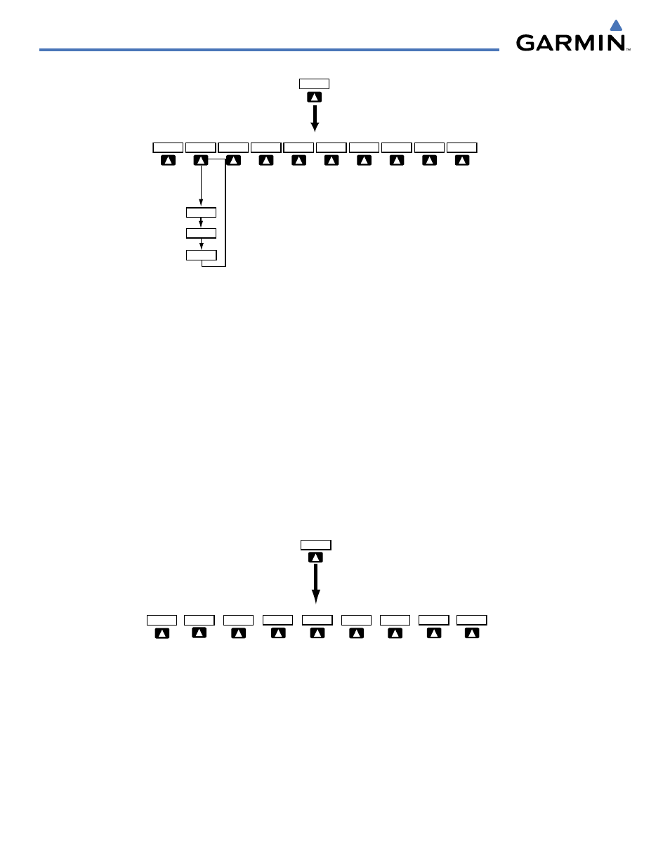
INSET
OFF
TOPO
TRAFFIC
TERRAIN
DCLTR
DCLTR-2
DCLTR-3
DCLTR-1
NEXRAD
Press the BACK or OFF softkey
to return to the top level
softkeys
XM LTNG
STRMSCP
BACK
ALERTS
(optional)
(optional)
(optional)
Figure 1-11 PFD Softkey Flow Chart – 1
TERRAIN
– Press to display terrain information on the Inset Map.
STRMSCP (optional)
– Press to display the Stormscope lightning data on the Inset Map (within a 200 nm radius of
the aircraft).
NEXRAD (optional)
– Press to display NEXRAD precipitation data on the Inset Map.
XM LTNG (optional)
– Press to display the XM Radio lightning data on the Inset Map.
BACK
– Press to return to the previous level softkey configuration.
ALERTS
– Press to display the Alerts window.
PFD – Press to display the additional softkeys for additional configuration of the PFD.
METRIC
– Press to display the current and reference altitudes in meters, in addition to feet. Pressing the metric softkey
also changes the barometric setting to hectopascals.
DFLTS
– Press to reset default settings on the PFD.
BRG1 (bearing)
– Press to cycle through the following information:
NAV1
– Displays NAV1 waypoint frequency or identifier in the BRG1 information window.
GPS
– Displays GPS waypoint identifier and GPS distance information in the BRG1 information window.
OFF
– Removes the BRG1 information window.
PFD
Press the STD BARO or BACK softkeys
to return to the top level softkeys
Press the DFLTS softkey to change the PFD
metric values to standard
ARC HSI
360 HSI
STD BARO
BACK
ALERTS
BRG2
BRG1
METRIC
DFLTS
Figure 1-12 PFD Softkey Flow Chart – 2