Gps navigation – Garmin G1000 Quest Kodiak User Manual
Page 137
190-00590-00 Rev. C
Garmin G1000 Pilot’s Guide for the Quest Kodiak 100
GPS NAVIGATION
5-21
D
ISPLAYING
T
OPOGRAPHIC
D
ATA
ON
THE
M
AP
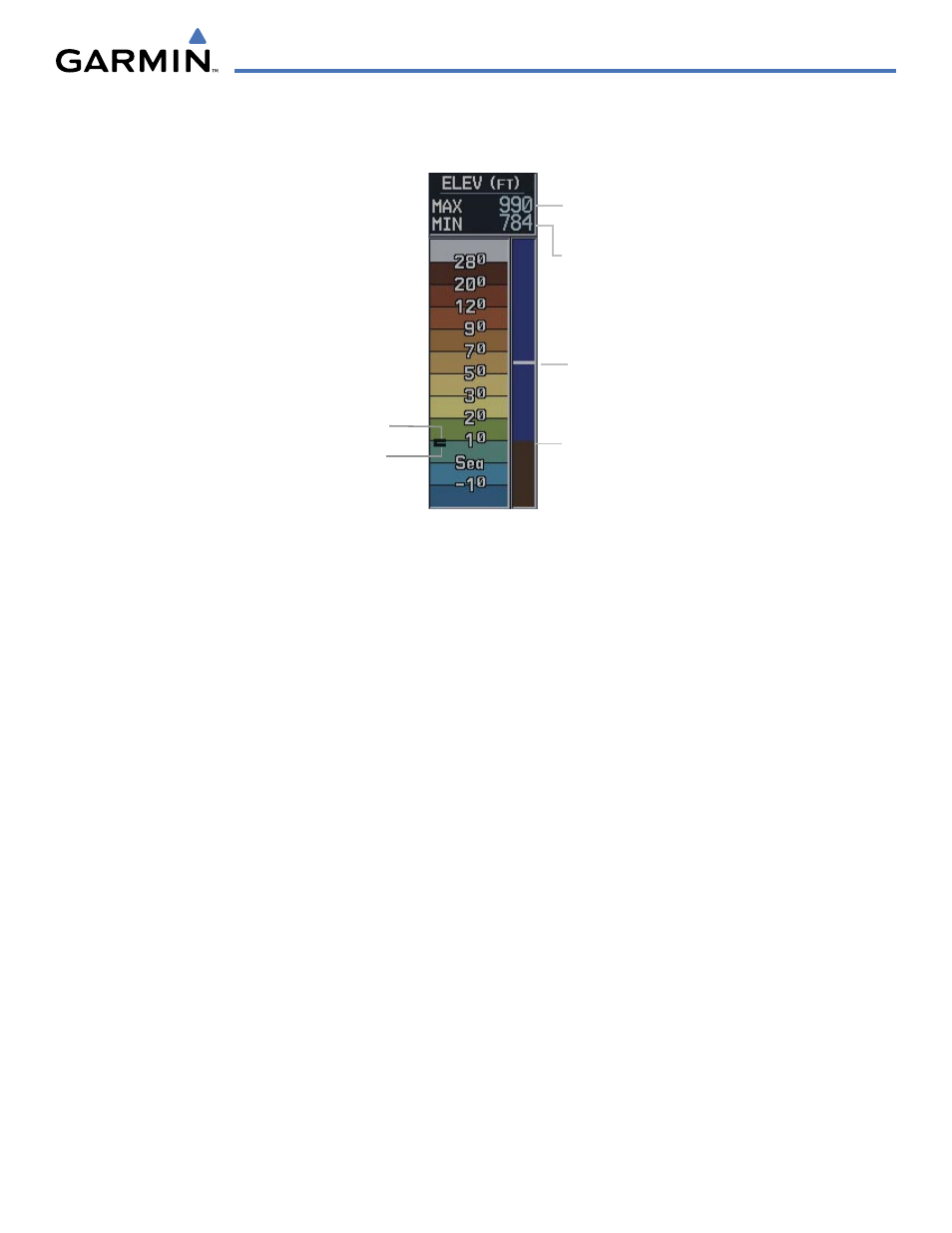
On-screen map maximum
elevation
On-screen map minimum
elevation
Ground Elevation
Aircraft Altitude
Figure 5-16 Topography Range Display
Maximum
Minimum
The Navigation Map displays various shades of topography land colors representing the rise and fall
of land elevation similar to aviation sectional charts (Figure 5-16). The Navigation Map can display a
topographic range representing various Key points of terrain elevation colors with their associated elevation
value labeled.
Displaying topographic data on the Navigation Map:
1)
Press the MAP Softkey.
2)
Press the TOPO Softkey. Topo data can also be displayed on the Navigation Map by using the ‘On/Off’ topo
data map setup feature. See the navigation map page setup MENU section for more information.
3)
Press the TOPO Softkey again to remove topo data from the Navigation Map. When topo data is removed from
the page, the Jeppesen Nav data is presented on a black background.