Hazard avoidance – Garmin G1000 Quest Kodiak User Manual
Page 259
190-00590-00 Rev. C
Garmin G1000 Pilot’s Guide for the Quest Kodiak 100
6-27
HAZARD AVOIDANCE
SETTING UP XM SATELLITE WEATHER ON THE NAVIGATION MAP
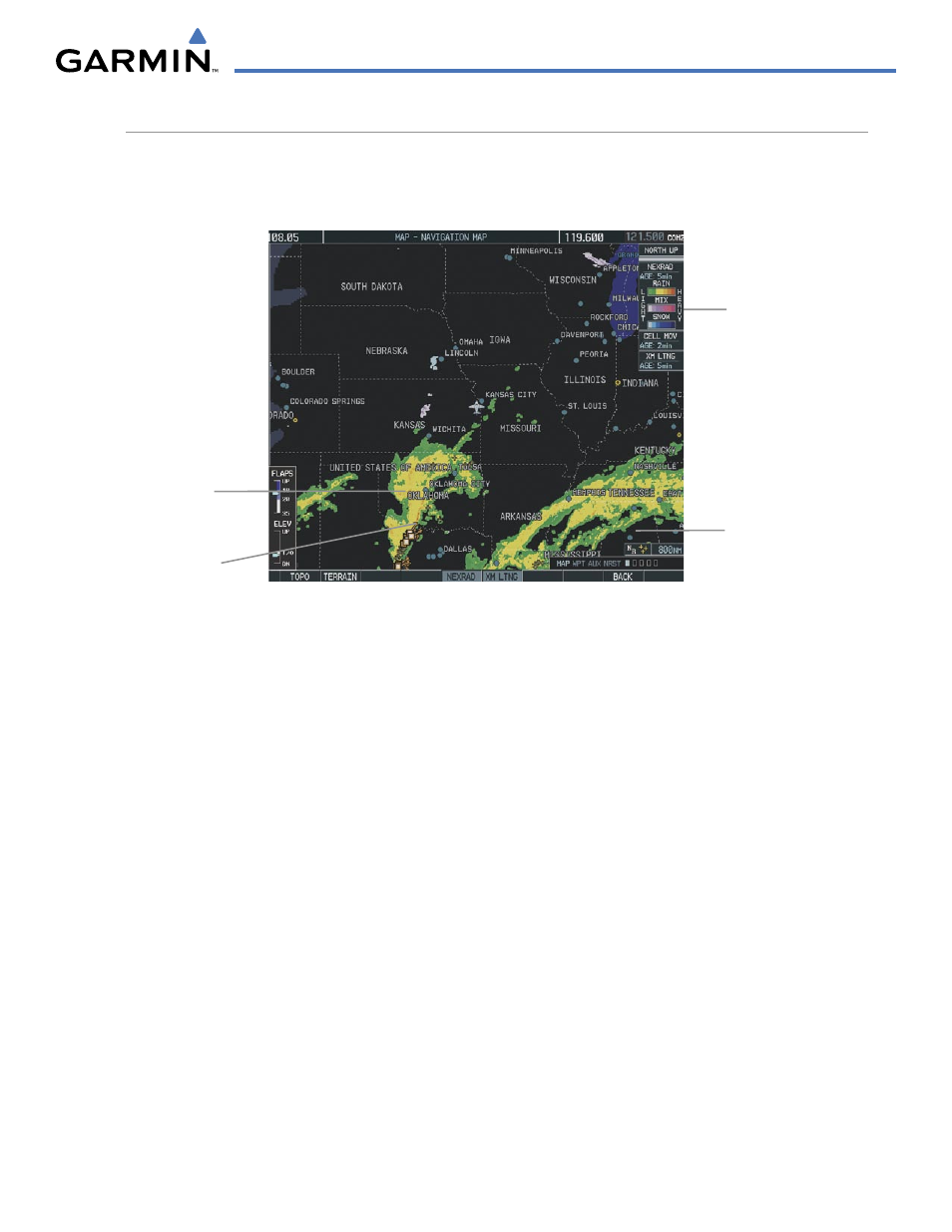
When appropriately configured, the Navigation Map displays NEXRAD, Cell Movement, TFRs, and XM
Lightning data as shown in Figure 6-35. This improves situational awareness and makes it easier to relate
storm activity to airports, NAVAIDS, obstacles, and other ground references.
Figure 6-35 Navigation Map Displaying NEXRAD Weather
NEXRAD
Weather
NEXRAD
Products, Storm
Legend, and Age
NEXRAD and XM
Lightning Icons, 800
nm Range
Cell Movement
Indication
See also other documents in the category Garmin Air equipment:
- GNS 530 (22 pages)
- GNS 530 (288 pages)
- aera 500 (202 pages)
- G1000 King Air C90GT (586 pages)
- G1000 Mooney M20TN (380 pages)
- G1000 Mooney M20TN (494 pages)
- G1000 Mooney M20TN (524 pages)
- GSD 21 (14 pages)
- G1000 Piper PA-46 Matrix (600 pages)
- NavTalk Pilot (176 pages)
- G1000 Socata TBM 850 (600 pages)
- G1000 Socata TBM 850 (542 pages)
- G1000 Socata TBM 850 (588 pages)
- G1000 Quest Kodiak (500 pages)
- G1000 Quest Kodiak (476 pages)
- G1000 Quest Kodiak (502 pages)
- GPS III Pilot (112 pages)
- GPS 400 (244 pages)
- GPS 95STD (111 pages)
- G1000 Piper PA-46 Meridian (572 pages)
- GPS 150XL (112 pages)
- GPSMAP 295 (16 pages)
- GPSMAP 295 (116 pages)
- GHC 20 (8 pages)
- GPS 90 (92 pages)
- GPSMAP 496 (164 pages)
- GPSMAP 496 (194 pages)
- MX20 (152 pages)
- G1000 Piper PA32 (450 pages)
- GPS 500 (256 pages)
- GPS 92 (84 pages)
- GPS 155XL TSO (146 pages)
- TR-1 (38 pages)
- TR-1 (8 pages)
- iQue 3600a (124 pages)
- GPS 165 TSO (132 pages)
- GPS 55AVD (88 pages)
- GPSMAP 396 (192 pages)
- GPS 150 (98 pages)
- GPSMAP 195 (114 pages)
- G950 Tecnam 2006T (348 pages)
- GPS 89 (68 pages)
- GHP 20 (28 pages)