Hazard avoidance taws page – Garmin G1000 Quest Kodiak User Manual
Page 263
190-00590-00 Rev. C
Garmin G1000 Pilot’s Guide for the Quest Kodiak 100
6-31
HAZARD AVOIDANCE
TAWS PAGE
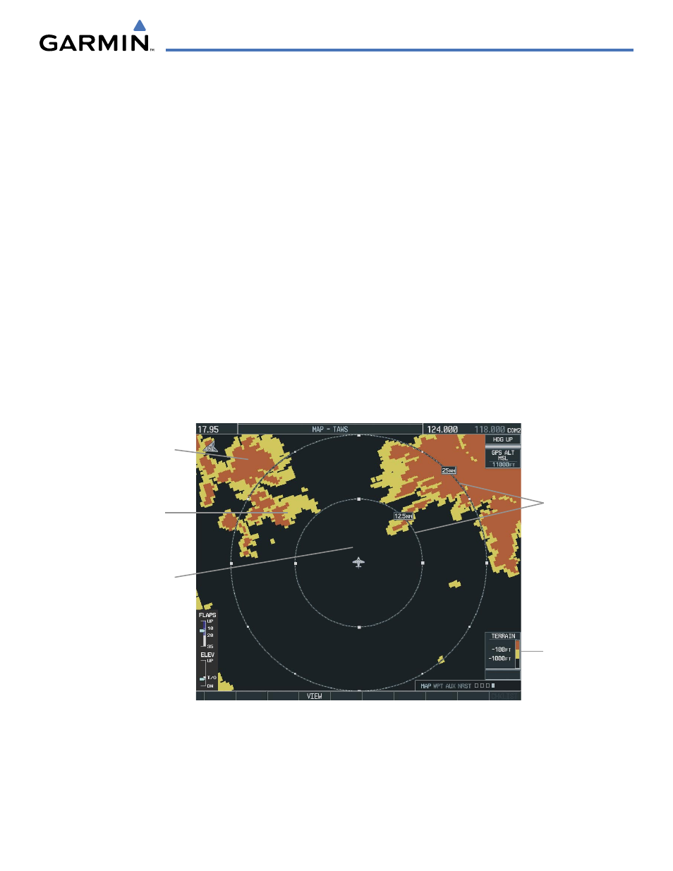
The TAWS Page is in the MAP group of pages and displays the following:
• GPS-derived MSL altitude in increments of 20 feet or 10 meters, depending on unit configuration
• Aircraft ground track
• Terrain Range - Indicates the terrain elevation in colors relative to the aircraft altitude
• Range marking rings (360º View: 1 nm, 1 and 2 nm, 2.5 and 5 nm, 5 and 10 nm, 12.5 and 25 nm, 25 and
50 nm, 50 and 100 nm, 100 and 200 nm) (Arc View: 1 nm, 2 nm, 5 nm, 10 nm, 25 nm, 25 and 50 nm, 25
and 100 nm, 25 and 200 nm)
• Heading Box (North Up, Track Up, DTK Up, HDG Up) - Heading on the TAWS Page displays ‘HDG Up’
map data, unless there is no valid heading
• Obstacles
• Potential Impact Points
Displaying the TAWS Page:
1)
Select the NAV Page Group.
2)
Select the last rectangular page icon.
3)
Turn the Joystick clockwise to display a larger area or counter-clockwise to display a smaller area.
Yellow Terrain
(Caution - Terrain
Between 100’ and
1000’ Below the
Aircraft Altitude)
Red Terrain (Warning
- Terrain Above or
Within 100’ Below
the Aircraft Altitude)
Black Terrain (No
Danger - Terrain More
than 1000’ Below the
Aircraft Altitude)
Map Range
Terrain Legend
Figure 6-37 TAWS Page (360˚ View)
The TAWS Page has two view settings:
• 360˚ View—Displays surrounding terrain on all sides of aircraft (Figure 6-37).
• ARC (120˚) View—Displays terrain ahead of and 60˚ to either side of the aircraft flight path (Figure 6-38).