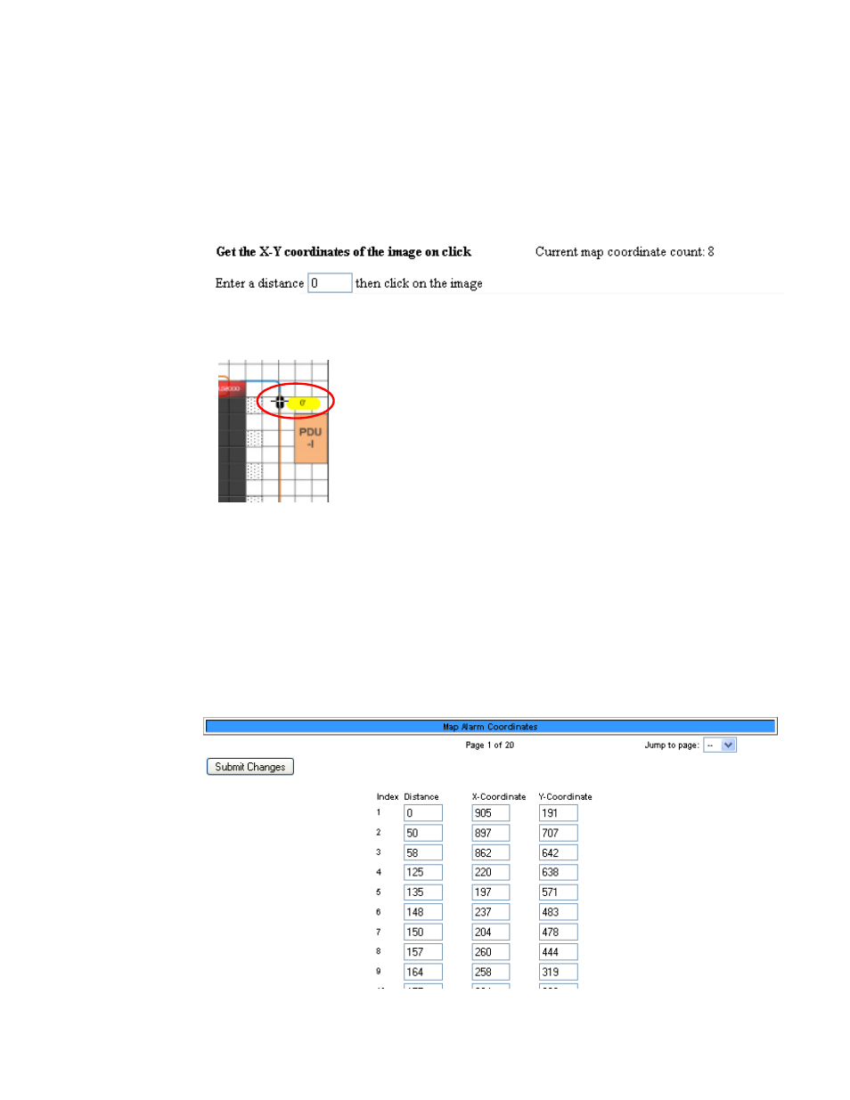
Figure 3.13 map coordinates—text view – RLE LD2100 V.2.6 User Manual
Page 41

rletech.com
LD2100 User Guide
41
3
Web Interface
2
Select the Yes radio button for Floor Map #1 Interactive.
3
Click the Map Alarm Coordinates - Graphical link near the bottom of the web page.
An enlarged view of the map displays.
4
In the “Enter a distance” box at the top of the web page, type 0 to set the reference point for
the beginning of the cable.
5
Click on the map to designate the location of the 0 point of the cable. The cursor displays as
cross hairs.
When you click on the map, the distance and the x-y coordinates of the location are stored
in the LD2100’s memory.
6
Enter the next distance to be recorded and click on the map in the corresponding location.
Repeat this step for each reference point you want to add to the map.
Note
It is recommended that you enter the cable distance each time the cable changes direction.
7
If any coordinates need to be adjusted, you can fine tune them through the Map Alarm
Coordinates - Text link on the Map Configuration page. Click this link to display all the
mapped coordinates and the distance readings associated with them.
Figure 3.13
Map Coordinates—Text View
Clicking on a map’s
reference point
