Navigating the map, Panning the chart, Enroute chart view right-click menu – Jeppesen JeppView 3 User Manual
Page 111: Routes
JeppView User's Guide
114
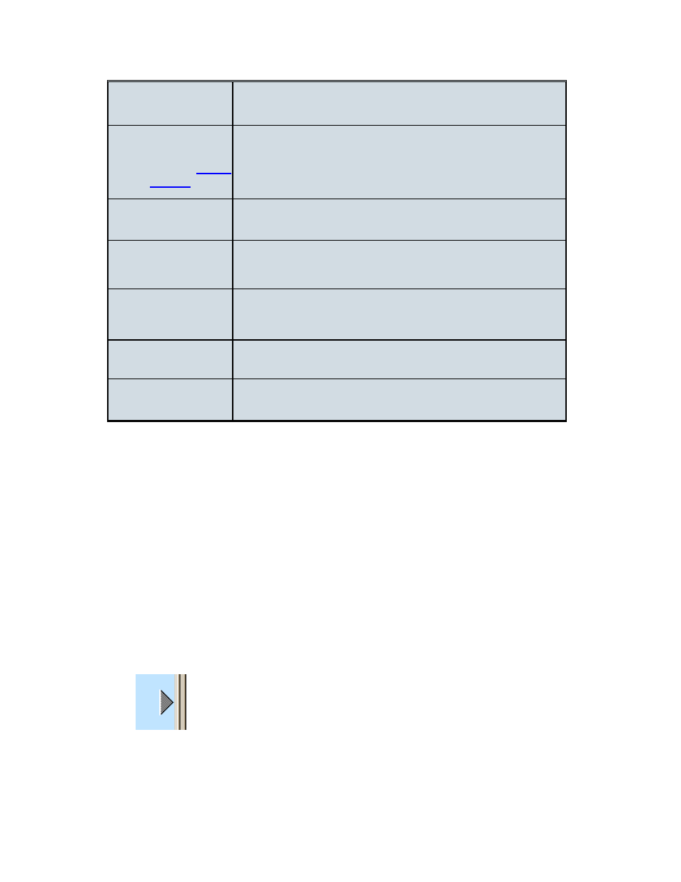
Find Approach
Charts
Locates the airport in the Airport List. (Available only
when the waypoint is an airport.)
Add [Airport]
Terminal Charts to
Adds the selected airport and all its currently filtered
charts to the RoutePack Other Charts folder. (Available
only when the waypoint is an airport.)
Center On
Centers the chart view on the selected object.
Show Approaches
Within
Opens the Filter Setup dialog box, which filters the
Airport List to show only airports within a selected
distance from the route.
Show Distance
From Here
Displays the distance from the selected waypoint to each
airport in the Airport List, and re-sorts the list from
nearest to most distant.
Delete
View and the program memory.
Properties
Opens the properties dialog box for the selected
waypoint.
Navigating the Map
The Enroute Charts View is your primary visual flight planning tool. You can view any
location within your coverage area. Unlike paper charts, JeppView enables you to
customize enroute charts, as well as display and print only the locations, zoom
levels, and chart objects you want. With JeppView, you can pan, zoom in and out,
revisit previous views, and center the enroute chart on a selected object, as well as
show or hide a variety of chart objects and features.
Panning the Chart
To pan on the enroute chart, do any of the following:
• Press the UP, DOWN, LEFT, or RIGHT arrow keys.
• Point to the edge (or corner) of the main window, so that the mouse pointer
becomes an arrow. Click to move in that direction.
• To autopan, hold down mouse button. The view continues panning until you
release the mouse button.