Using the enroute chart, Utilizing the enroute chart – Jeppesen JeppView 3 User Manual
Page 109
JeppView User's Guide
112
Using the Enroute Chart
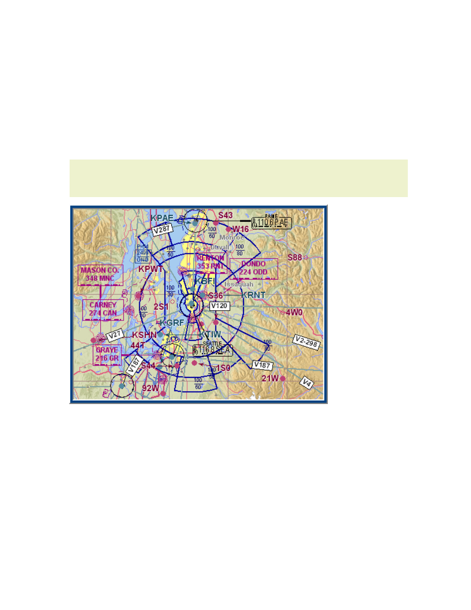
The
vector chart
you see when you first open JeppView is a computer-generated map
drawn from tabular information in several databases. The charts included with
JeppView should not be used as a sole means of navigation. Vector charts offer fast
rendering, continuous zooming, feature display selection, and easy updates to
NavData. An example of JeppView's built-in Default theme vector chart with terrain
appears below.
NOTE
The Enroute Charts View is for reference only, and not meant to be a
replacement for paper charts. Due to decluttering constraints, some data
elements (such as segment distances) may not be available.
Certain map elements might be visible or hidden for certain themes. The high and
low enroute themes are the most controlled and correspond as closely as possible to
the printed versions, but all the themes have constraints as to which map elements
display at which zoom levels.
View the following topics to become more familiar with the functions of the enroute
chart:
•
•
•
Displaying Chart Object Properties
•
Working with User-Defined Waypoints
•