72 system functions – Leica Geosystems TPS1100 Professional Series - User Manual User Manual
Page 72
72
System functions
TPS1100 - User Manual 2.2.1en
Sets the geometrical ppm to
"0.00".
The scale on the Central Meridian is
set to "1.0000000". The other
parameters are set to "0.00".
The individual scale correction can
be used to enter a total geometrical
correction.
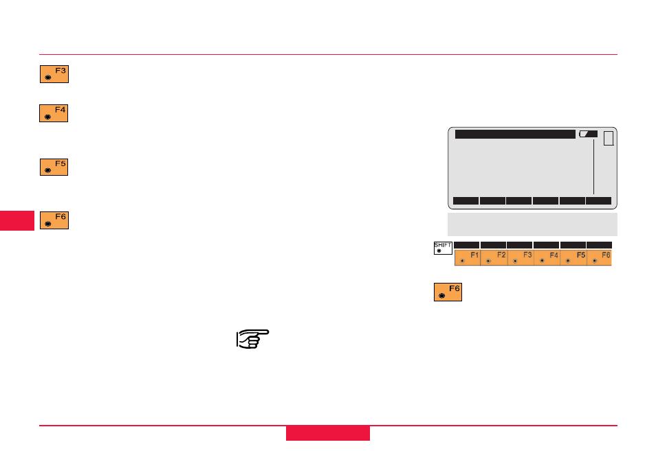
\ GEOMETRIC CORR.
Scale C.M.
: 1.0000000
Offset C.M.
:
51000 m
Height aRef
:
350 m
Indiv. ppm
:
0.0
ppm geometric :
-22.9
CONT
GEO=0
MC
QUIT
ppm ref. level :
0.0
ppm map projection:
0.0
Distance corrections ppm, continued
Geometrical correction
The geometrical distance correction
is derived from the projection
distortion and the height above the
reference datum.
The calculation of the geometrical
ppm follows the formula for the
Transversal Mercator Projection.
The individual factors are: the scale
factor of the line of projection (central
meridian, Gauss-Krüger = 1.0, UTM
= 0.9996, etc.); the offset from the
line of projection; the height above
the reference datum (normally this is
the height above mean sea-level);
and an additional individual scale
correction.
The distance without any
projection distortion is used
to determine the height difference.
The individually-set scale adjustment
is always applied to the distance.
Settings for the refraction
correction.
Toggle between air pressure
and height above mean sea-
level.
Toggle between relative air
humidity and wet-air
temperature.
Set the atmospheric ppm to
"0.00". (Individual parameters
are set to the standard atmospheric
values, corresponding to the
atmospheric correction ATM=0)