Figure 15-107 search detail – BendixKing KSN 770 - Pilots Guide User Manual
Page 386
KSN 765/770 Integrated Communication Navigation Display
D200802000009
REV 2 Jun 2014
15-113
Flight Management System (FMS)
Honeywell International Inc. Do not copy without express permission of Honeywell.
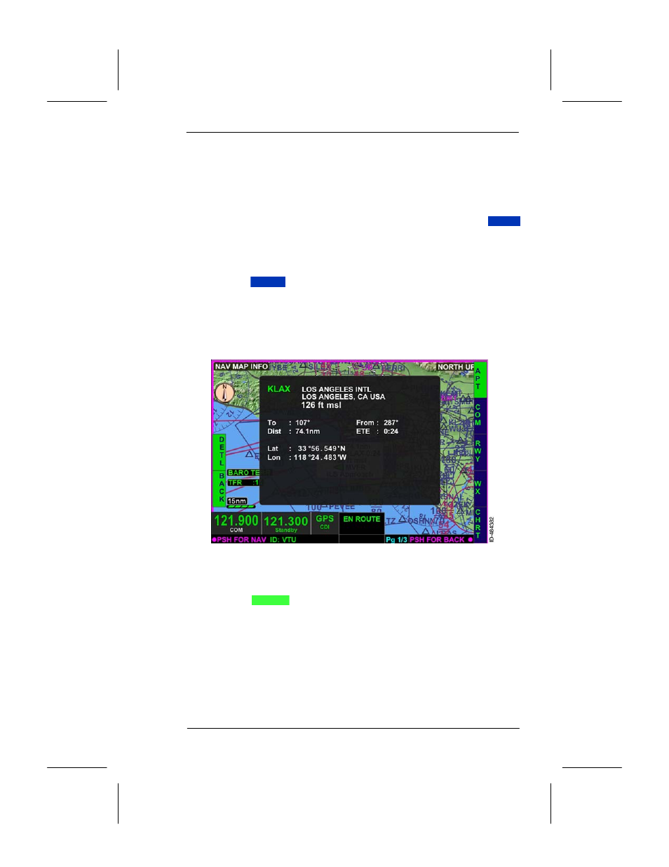
The navigation map view defaults to the barometric terrain overlay,
north--up view, and declutter level on high. These defaults cannot be
changed by the pilot when in the search navigation map view.
The entered navigation database waypoint is displayed in the center of
the navigation map view. A cursor box is displayed below the selected
waypoint which is the same cursor box displayed when the
INFO
bezel softkey, described in Section 6, Navigation Map View, is selected.
Information such as magnetic course, distance, ETE, elevation, and
type of approaches (when available) are displayed.
Pushing the
DETL
bezel softkey displays a detail information box
based on the navigation database waypoint. This is the same
navigation map detail window described in Section 6, Navigation Map
View. Detailed information about the airport, radio communications,
runway, weather, and charts are displayed by selecting any of the
right--side bezel softkey labels displayed in Figure 15--107.
Figure 15--107
Search Detail
Pushing the
BACK
bezel softkey or pushing in the joystick knob
returns to the FMS display window.