Terrain view - above ground level (agl) display – BendixKing KSN 770 - Pilots Guide User Manual
Page 177
KSN 765/770 Integrated Communication Navigation Display
D200802000009
REV 2 Jun 2014
8-5
Terrain View
Honeywell International Inc. Do not copy without express permission of Honeywell.
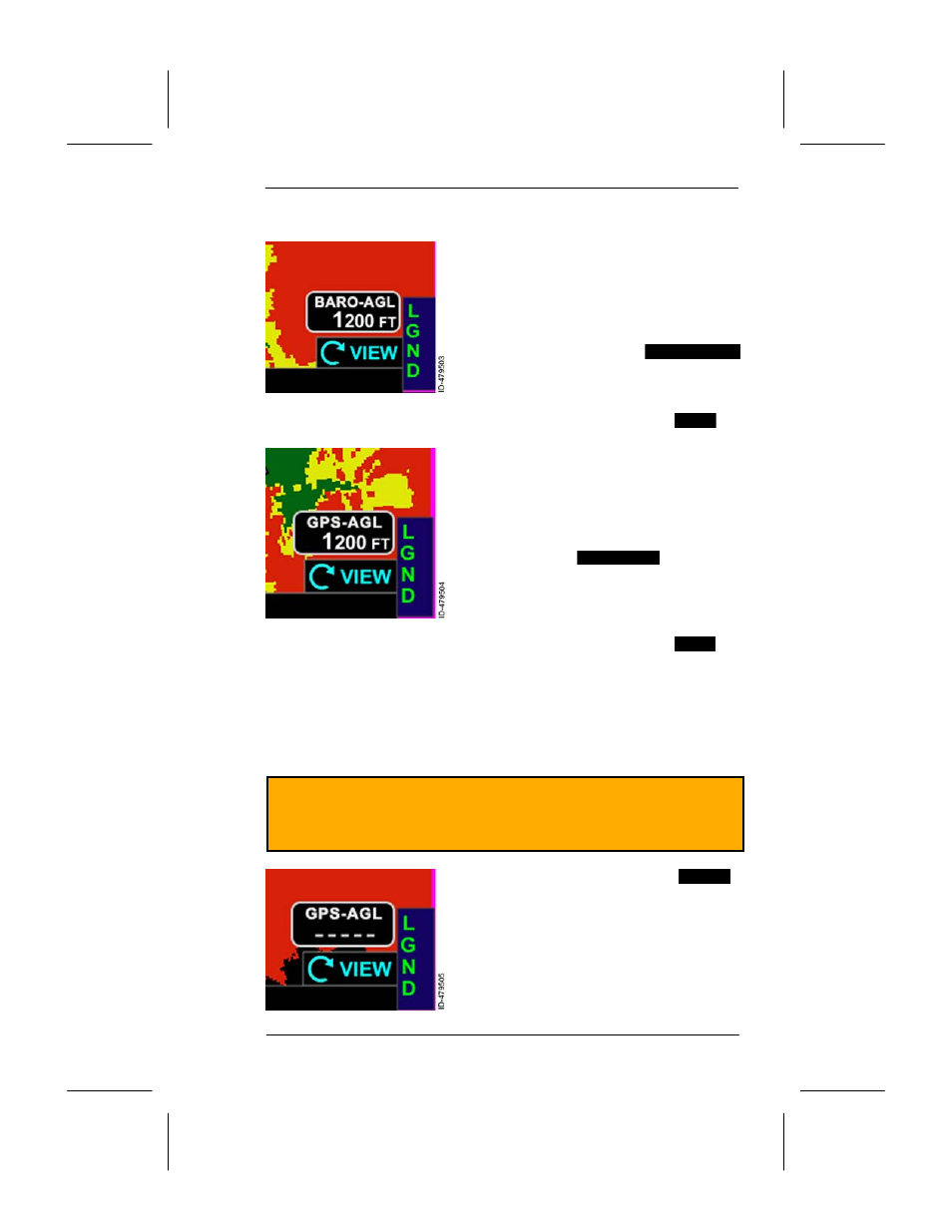
Terrain View -- Above Ground Level (AGL) Display
When configured to receive corrected
barometric altitude and corrected
barometric altitude is available and
valid, the current height AGL, as
computed from baro--corrected altitude
and the terrain height directly below the
aircraft, is shown in the
BARO--AGL
box in the lower--right of the display.
NOTE: In thumbnail views, the annunciation is shown as
AGL
.
When corrected barometric altitude is
not available, not configured, or invalid
and GPS altitude is available and valid,
the current height AGL, as computed
from the GPS altitude and the terrain
height directly below the aircraft, is
shown in the
GPS--AGL
box in the
lower--right of the display.
NOTE: In thumbnail views, the annunciation is shown as
GSL
.
The AGL values are displayed and rounded down to the nearest
hundreds of feet (i.e., 899 feet is rounded to 800 feet).
NOTE: The AGL value is not displayed if the GPS position
information is not available.
CAUTION
CORRECT BAROMETRIC PRESSURE IS ESSENTIAL TO
ACCURATE TERRAIN DEPICTION.
The AGL value is dashed (
----------
)
when there is no terrain coverage for
the present position, or when the AGL
value is above 51,000 feet or below
500 feet.