Figure 6-14 terrain overlay, Terrain overlay – BendixKing KSN 770 - Pilots Guide User Manual
Page 129
KSN 765/770 Integrated Communication Navigation Display
D200802000009
REV 2 Jun 2014
6-31
Navigation Map View
Honeywell International Inc. Do not copy without express permission of Honeywell.
Terrain Overlay
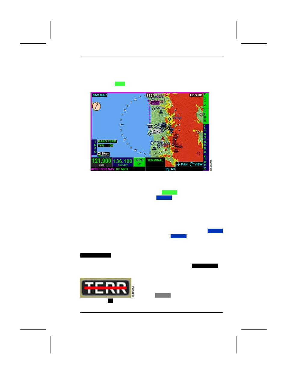
The terrain overlay permits terrain data to overlay on the navigation
map display. The terrain overlay is controlled using the TERR bezel
softkey on page
2--2
displayed in 2R shown in Figure 6--14.
Figure 6--14
Terrain Overlay
The terrain overlay is active when the
TERR
bezel softkey label is
displayed and inactive when the
TERR
bezel softkey label is
displayed.
NOTE: When the terrain overlay is inactive, only obstructions within
500 feet are displayed.
The terrain overlay and NEXRAD overlay are mutually exclusive. Only
one can be displayed at a time on the navigation map. The
TERR
bezel softkey label is inactive when the
NXRD
bezel softkey is
pushed.
When corrected barometric altitude is configured and valid, the
BARO TERR
annunciation is displayed in the lower--left corner of the
display, as shown in Figure 6--14. When barometric altitude is not
configured or invalid and geometric altitude is valid,
GPS TERR
is
displayed in the lower--left corner of the display.
If the corrected barometric altitude,
geometric altitude, aircraft position, or
heading and GPS track are invalid, a
white
TERR
annunciator is displayed
with a red (
--
) line through the annunciator and the obstruction
coloring is removed from the display.