Regional auto route planning in 3d – FeiYu Tech FY-Panda2 Autopilot User Manual
Page 46
Guilin Feiyu Electronic Technology Co., Ltd.
Guilin Feiyu Electronic Technology Co., Ltd http://www.feiyu-tech.com [email protected]
Page 43
15.2.2 Regional Auto Route Planning In 3D
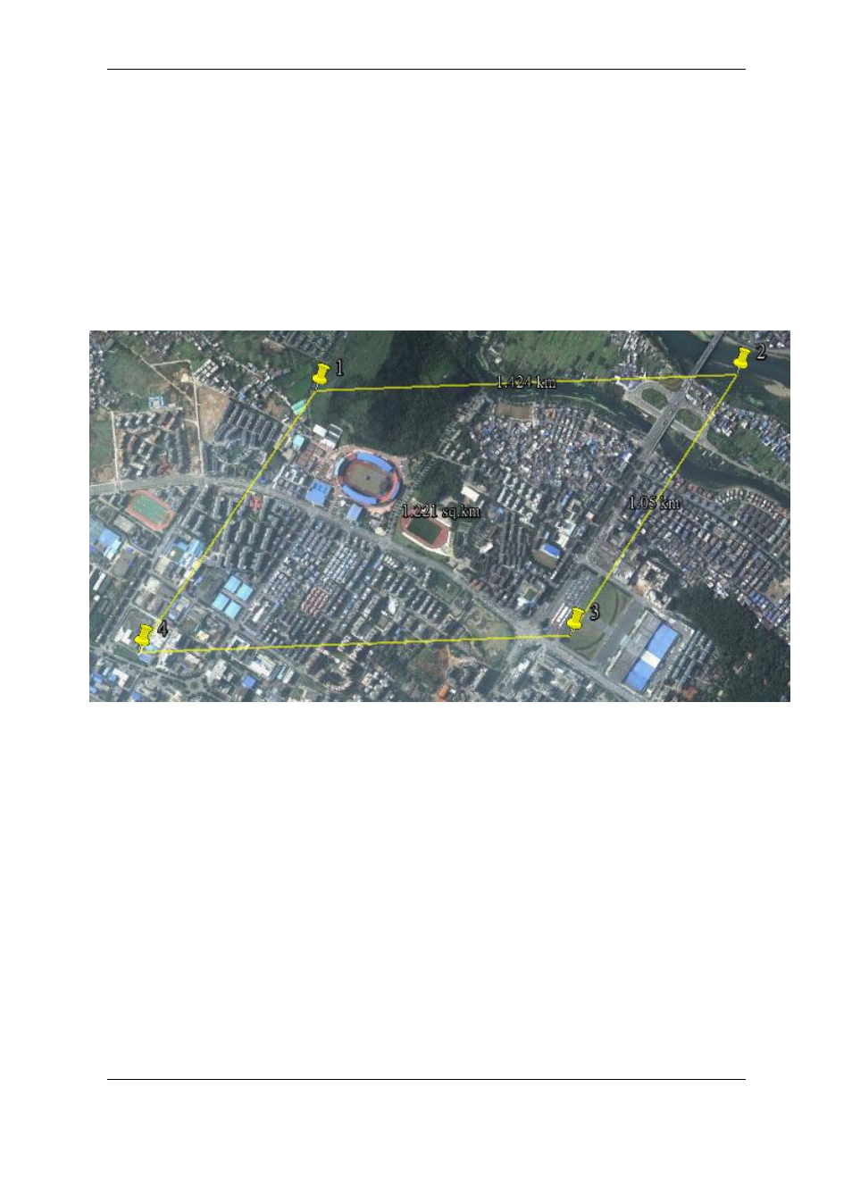
After initialized altitude .Input the route altitude, spacing, turn distance in parameter
edit box, click on
―Set‖ button to confirm the setting. Click on the ―Area Start‖ button
mouse change into gripper type,
press on ―Ctrl‖ button on the keyboard, select three
vertices of the target area on the map, the fourth vertex of the area will
generated automatically. Show in the following picture (It will display the total area in the
area, for example:1.221sq.km).
Figure
Diagram Of The Area
Loosen the "Ctrl" button, click on the
―Area End‖ button, it will generate aerial routes
in the area automatically, shown in picture (It will display the total distance in the area, for
example: 11.591 km). If connected to autopilot system which the GPS have not fixed
position, area route planning will generate the route starting point and ending point at the
center of the area, for example the point 1 and the point 12. If connected to autopilot
system which the GPS have fixed position, area route planning will generate the route
starting point and ending point at current position of the aircraft.