Automatic landing point setting – FeiYu Tech FY-Panda2 Autopilot User Manual
Page 39
Guilin Feiyu Electronic Technology Co., Ltd.
Guilin Feiyu Electronic Technology Co., Ltd http://www.feiyu-tech.com [email protected]
Page 36
14.4.3 Automatic Landing Point Setting
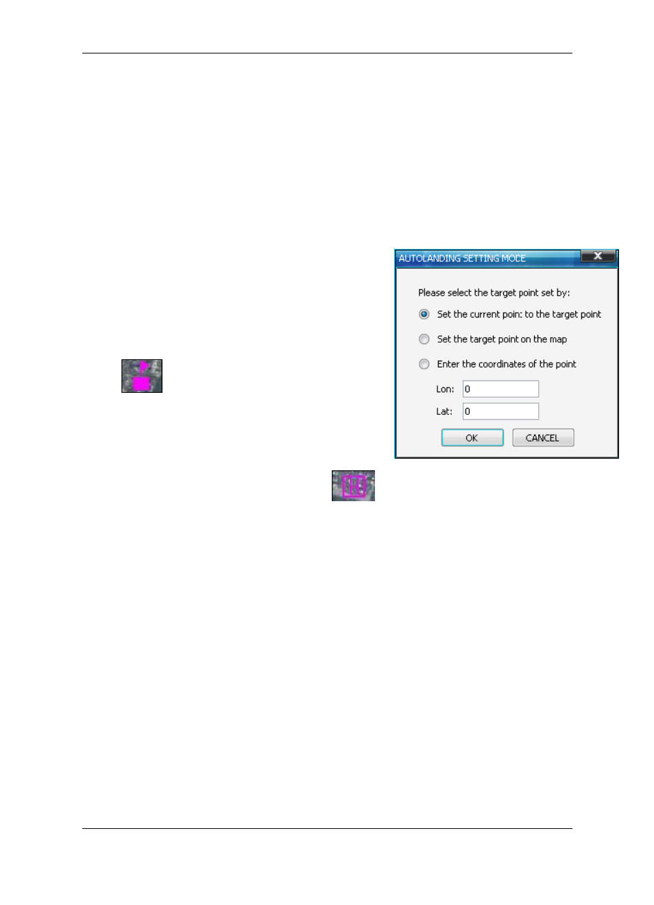
There are three option for landing point setting .The landing point can set up in 2D
view or 3D view on the GCS. Introduce the setting in 2D view as a reference, setting in
3D view please refer to the manual of the GCS.
Click on the
―Land Start‖ or ―Land End‖ button in page ―Route‖ in the parameter
setting bar. Select the setting mode in the pop up setting dialog.
① Set the current point to the target point:
Wait for the GPS positioning well, then take the
aircraft to the point of landing route,
click the ―Land
Start
‖ button, select the ―Set the current point to the
target point
‖ in the setting dialog then click the ―OK‖
button to set the current point as the landing starting
point ― ‖. Take the aircraft to the ending point
of landing route, click the
‖ Land End ‖ button, select
the
―Set the current point to the target point‖ in the
selection dialog then click on
―OK‖ button to set the
current position as the landing ending point
― ‖.
② Set the target point on the map : In this setting mode, fine the target point then
mouse click on the map to set the landing start point or landing end point. Right click the
mouse to exit the setting landing point mode.
③ Enter the coordinates of the point : In this setting mode, enter the latitude and
longitude of the target point then click the
― OK ‖ button, the landing starting point or
landing end point will be mark on the map. Unit of the latitude and longitude is degree,
input in decimal format.
For Example: setting a landing start point at east longitude:110.283, northern
latitude:25.277
(According to the international standard: the west longitude, south
latitude expressed by negative value)
Click on
‖ Land Start ‖select the‖ Enter the coordinates of the point‖, enter :