27 map (facility mapping), Map (facility mapping), Figure 3.52 fms map – RLE FMS V.1.13 User Manual
Page 114
114
FMS User Guide
800.518.1519
3
Web Interface Configuration
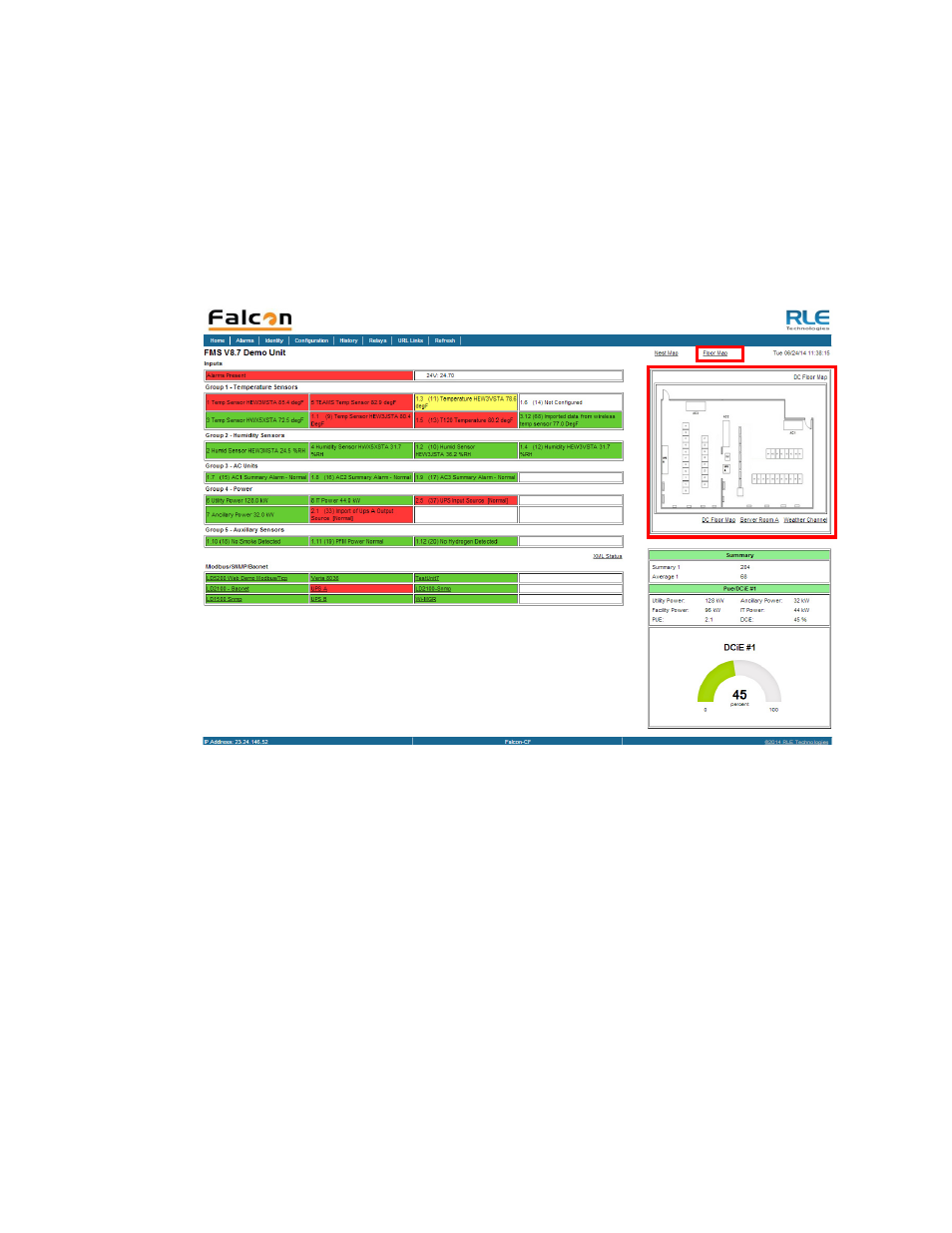
3.4.27 Map (Facility Mapping)
The FMS allows users to upload a map of their facility and populate it with FMS data. This
provides users with a real-time view of their facility, and the physical location and status of all
their digital, analog, and Modbus/SNMP slave inputs.
Through the FMS mapping process, the Falcon creates an overlay for an uploaded map image.
It superimposes the locations of your inputs - based on coordinates you designate - over the
top of your map image. Once uploaded and populated, the map is accessible through links on
the FMS home page.
Figure 3.52
FMS Map
Mapping is the last step in the FMS setup process. Do not attempt to map your facility until
your monitoring area is completely assembled - all of your sensors and equipment are in place,
wired, and functional. Mapping is faster if all your inputs have been configured through the
FMS Configuration Menu.
Several tasks are key to the success of facility mapping. First, update the firmware on your
FMS (refer to
Chapter 8, “Load Firmware and Configuration Data” on page 171
for firmware
uploads). Facility mapping is only available on FMS firmware version 8.6.4 or greater.
Secondly, you’ll need a map of your facility. The map needs to be in .jpg format, and must
have a file size less than 500kb. The maximum physical size of the map is 4000 x 4000 pixels.
Since the Falcon never actually edits your map, if you should need to update your map image,
previously designated map points will not need to be reconfigured. As long as you do not
change size of your map, previously mapped coordinates should not need to be adjusted when
you upload a new version of your map.