BendixKing AV8OR User Manual
Page 51
Honeywell Bendix/King AV8OR Handheld User’s Guide
D200803000008
VFR Moving Map Function
Rev 5 Mar 2012
Page 2-11
©
Honeywell International Inc. Do not copy without express permission of Honeywell
the north pointer toggles the map orientation between North Up and
the Track Up mode.
Map Page (4)
: The map page is the main page for Go Fly aviation
mode. The map page shows the aircraft position on the map.
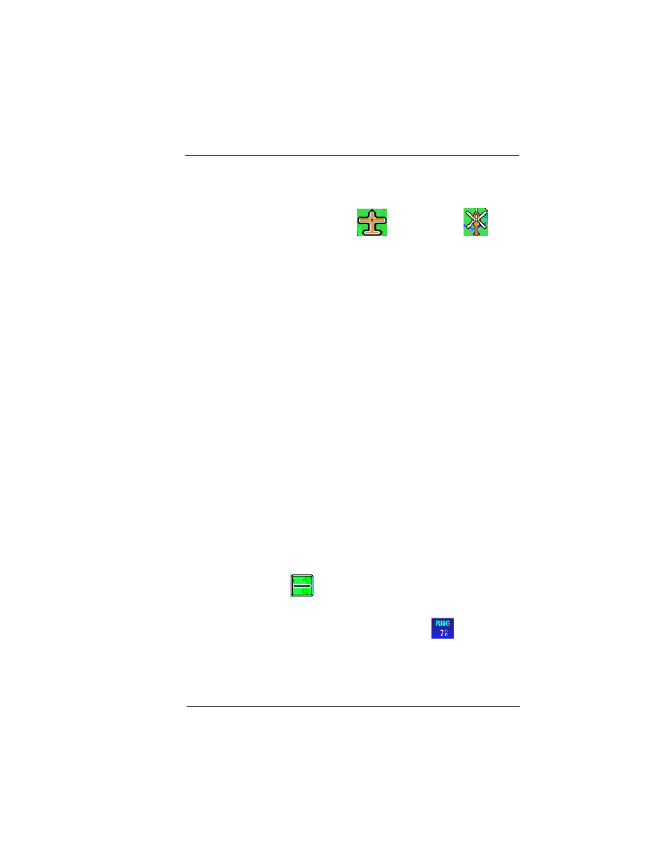
Aircraft Symbol (5):
A Fixed wing
or Rotary wing
aircraft symbol is displayed in the center of the screen that
represents the actual position of the aircraft. The aircraft symbol
points in the direction of the GPS track based on a valid GPS
position fix.
•
If Rotary Wing is selected as aircraft type, and AV8OR loses a
valid GPS position fix, the aircraft symbol is removed from the
screen.
•
If Fixed Wing is selected as the aircraft type, and the aircraft
stops, the aircraft symbol stays on the screen and point in the
direction of the last known GPS track. When the GPS speed is
greater than 3 kts, the aircraft symbol follows the GPS track as
the heading source. The symbol is changed in the System Setup
– General System Setup page.
Menu Soft keys (6):
The menu soft keys are displayed on the right
side of the screen. They allow the user to navigate through the menu
directory. The soft keys are shown initially when the Map page is first
displayed. After a configurable period of time, the soft keys are
removed from the Map page. Tapping on the Map page causes the
menu soft keys to display again. The
MAIN MENU
soft key returns to
the Aviation Main Menu page.
Title Bar (7):
The title bar shows the currently selected map view
across the bottom of the Map page. The Title Bar area also provides
fast access to primary pages. For more information on how fast
access works, refer to the Fast Access section on page 2-12.
The
ZOOM OUT (8)
icon increases the displayed range of the
map.
Map Range (9)
: The current range (labeled
RNG
) is displayed
in the range tag window in the lower left corner of the display. The
range distance unit (nautical miles, statute miles or kilometers) is
configured in the System Setup-GENERAL SYSTEM SETUP page.
Range is measured on the map as the distance from the center of
the aircraft symbol to the outer ring around the aircraft. The inner