Garmin 210 User Manual
Page 34
Attention! The text in this document has been recognized automatically. To view the original document, you can use the "Original mode".
CDf Scale
Nflvigatioii D
*I
ETE:
ee:l7:5S
ETfl: 14:54
e.95"n.
177°
3.0^
143°
N
3S'56.a95'
MB7E°2E.1B3-
14-fiPR-94
14:35:45
LESIi!^Jll£!S£E^i]ll!!S£L£!SJl_j!SL_|ISS£££SO
Whenever you are off course by more than
the selected CD! scale, your distance off
course will he displayed in place of the
CD]
scale setting. An arrow icon will also appear,
indicating which direction to steer to get back
on course.
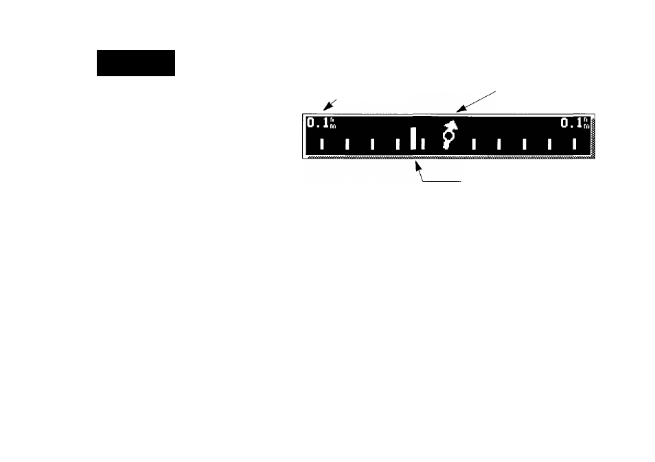
The GPSMAP Navigation Page’s graphic course deviation indicator (GDI) is
located directly below the speed and course fields.
CD! Scale Range
Relative Bearing Pointer
24
D-Bar Indicator
The GDI scale features a large arrow in the center, which always points to
your destination waypoint relative to the direction you’re moving in. The ver
tical bar on the scale moves from side to side, indicating how far off course
you are from your desired track, relative to the scale value shown at the top
left and right of the scale. As you navigate to a destination, you want to try to
keep the vertical bar as close to the center of the scale. If you exceed the scale
setting of the GDI, the scale value numbers will change to indicate the dis
tance and direction you are off course. To change the GDI scale and steering
guidance preferences, refer to Section 10.
The last two fields on the Navigation Page are the position and date/time
fields. The position field displays your present GPS position or a simulator
mode position you have entered manually. The date/time field displays the
current date and time as calculated from GPS satellites. The date and time for
mats may be changed through the system setup softkey (see Section 10), and
the time may be set to display either UTC (Greenwich Mean Time) time or the
local time, based on a local offset entered in the system setup menu.