Page – Garmin 210 User Manual
Page 27
Attention! The text in this document has been recognized automatically. To view the original document, you can use the "Original mode".
[ Routes^l Maypts Jll Map Cf flux [jlRng/Brgji ,
Destination
Field
Data
Window
Softkey
Menu
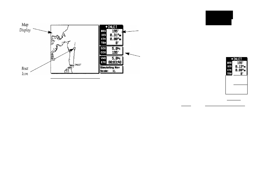
The GPSMAP Map Page provides a comprehensive display of electronic
cartography, plotting and navigational data. It is the primary page used for
navigating with the GPSMAP system. The Map Page can be broken down
into three main sections: map display data window and softkey menu.
The map display shows your boat on an electronically generated chart,
complete with geographic names, navaids, depth contours and a host of other
chart features. It also plots your track and displays any routes and waypoints
you create. An on-screen cursor lets you pan and scroll to other map areas,
determine the distance and bearing to a position, and perform various route
and waypoint functions. The GPSMAP system has a built-in world wide data
base to 64 n.m.fsee Appendix F for built-in coverage map), with more detailed
coverage available through the use of G-chart™ data cartridges
(see Section 11 for installing and using G-chart™ cartridges).
m V
PAGE
Ovcm'cw
S.Bkt
195“
s
s.ext
00:81:31
Simulating Hav
Scale; D.2SS,
I Routet ill
11 Map Cfg tl
jfRng/Bpgll
Your boat's position is represented by a wedge
icon, with your track plot shown as a dotted
line (MAP 205/GPSMAP210) or a solid
yellow line (GPSMAP220).
To select what chart features are displayed
on a particular chart scale, refer to the Map
Configuration section on pages 44-45.
17