Gpsmap i – Garmin 210 User Manual
Page 15
Attention! The text in this document has been recognized automatically. To view the original document, you can use the "Original mode".
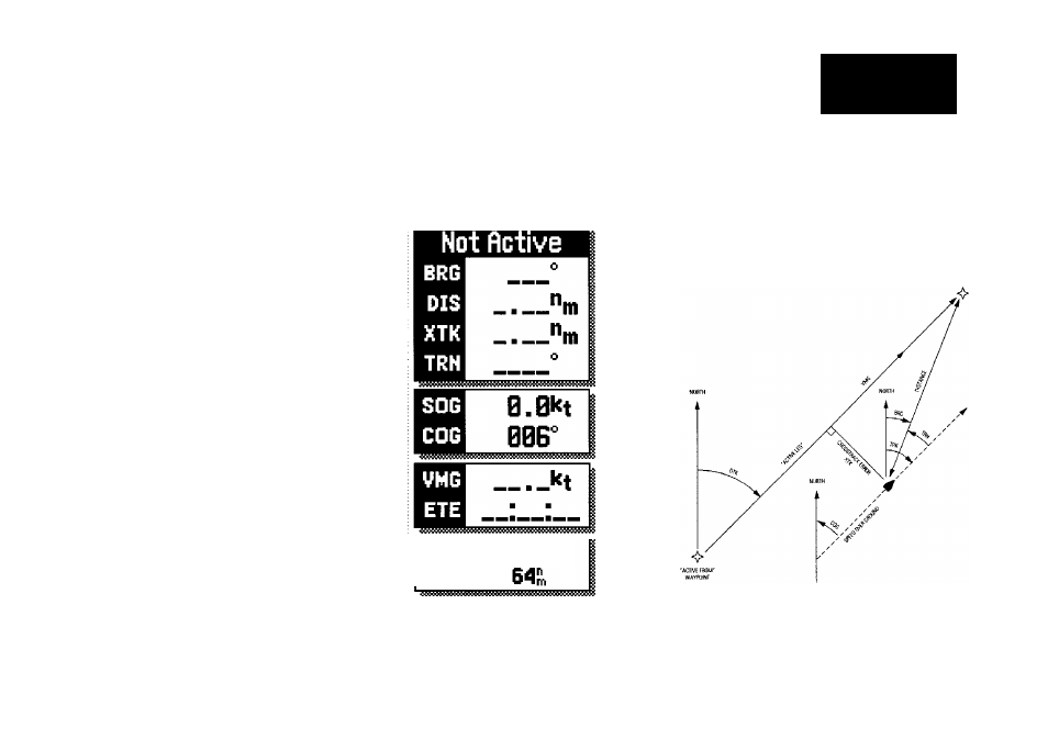
The destination field, located at the top of the data window, shows your
bearing and distance to a destination waypoint or to the cursor. It also displays
your crosstrack error (XTK) and turn (TRN) heading to an active destination.
The XTK value is the distance you are off a desired course, while TRN repre
sents the direction (left or right) in degrees between the bearing to your desti
nation and your course over ground (COG).
The speed and course field, located
below the destination field, displays your
present speed and course over ground
(SOG and COG).
Below the speed and course field are the
arrival and status fields. The arrival field
displays your velocity made good (VMG)
and estimated time enroute (ETE). Your
velocity made good is the speed you are
closing in on a destination along your
desired track, while the ETE represents the
total time left to your destination based on
your current VMG.
The status field indicates the operating
mode and map scale currently in use.
The map scale represents the approximate
distance from the top of the map display
to the bottom.
The softkey menu provides you with direct access to the GPSMAP’s route,
waypoint, auxiliary and range/bearing calculation functions.
Simulating
Nav
Scale:
GPSMAP I
0
№
Map Page
For a glossary of navigation terms, select the
‘Glossary’ option from the Auxiliary Options
Menu or see pages 15-lb.