Procedures – Garmin GNS 430 User Manual
Page 83
75
PROCEDURES
Approach with Hold
Example
5
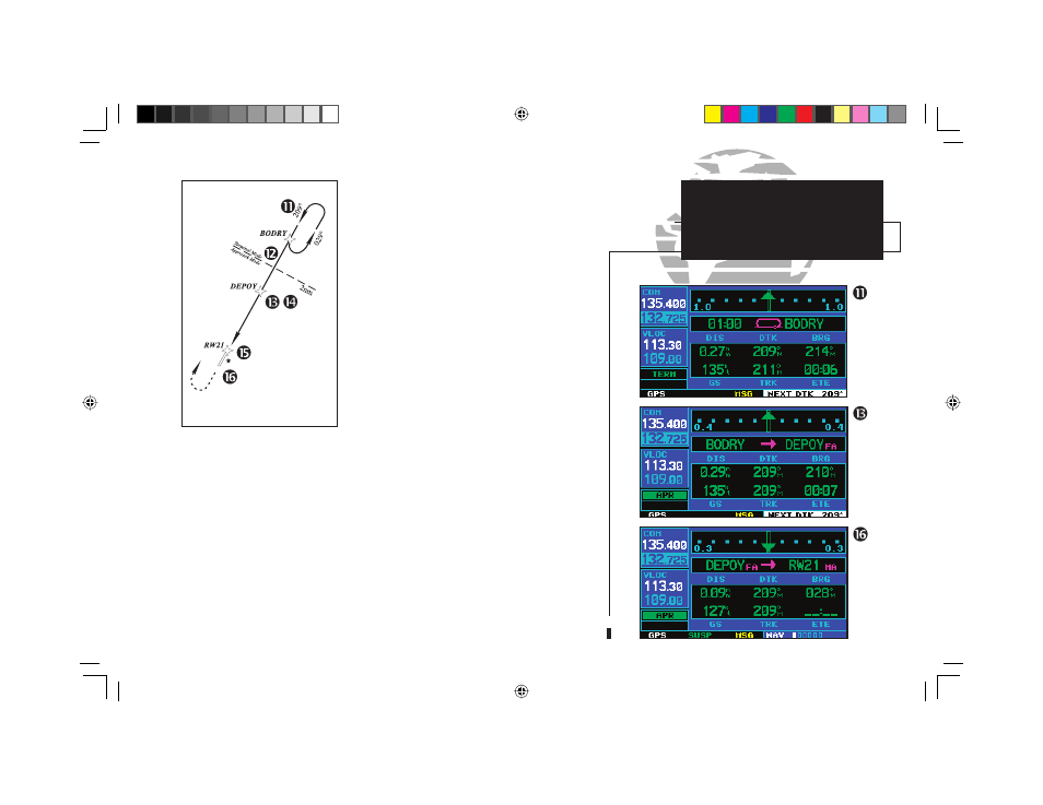
11. Also as you approach BODRY intersection, a waypoint alert
(”NEXT DTK 209°”) will appear in the lower right corner of the
screen.
12. At 2.0 nautical miles from the FAF (DEPOY intersection), the
GNS 430 will switch from terminal mode to approach mode. CDI
scaling will be tightened from 1.0 to 0.3 nautical mile, full scale
deflection.
13. As you approach the FAF, a waypoint alert in the lower right cor-
ner (“NEXT DTK 209°”) will appear. Make any course adjustments
necessary for the final course segment (FAF to MAP).
14. As you cross the FAF, the destination sequences to the MAP
(“RW21”, the runway threshold). With the needle centered, fly toward
the MAP, observing the altitude minimums dictated by the approach
plate. (When viewing the map page, you’ll note that the final course
segment is displayed in magenta—the active leg of the flight plan
always appears in magenta—and a dashed line extends the course
beyond the MAP. Do NOT follow this extended course. Instead, fol-
low published missed approach procedures.)
15. As you approach the MAP, a waypoint alert (“APPRCHING WPT”)
will appear in the lower right corner.
16. As you cross the MAP, “SUSP” will appear above the
O
key, indicating that automatic sequencing
of approach waypoints will be suspended at the MAP. A “from” indication will be displayed on the CDI
and default NAV page, but course guidance along the final approach course will continue. If a missed
approach is required, use the
O
key to initiate the missed approach sequence, as outlined on page
72.
DO NOT USE FOR
NAVIGATION
190-00140-00.indd 75
5/7/2003, 5:17:12 PM