Nav pages, Rq o p – Garmin GNS 430 User Manual
Page 55
47
2
NAV PAGES
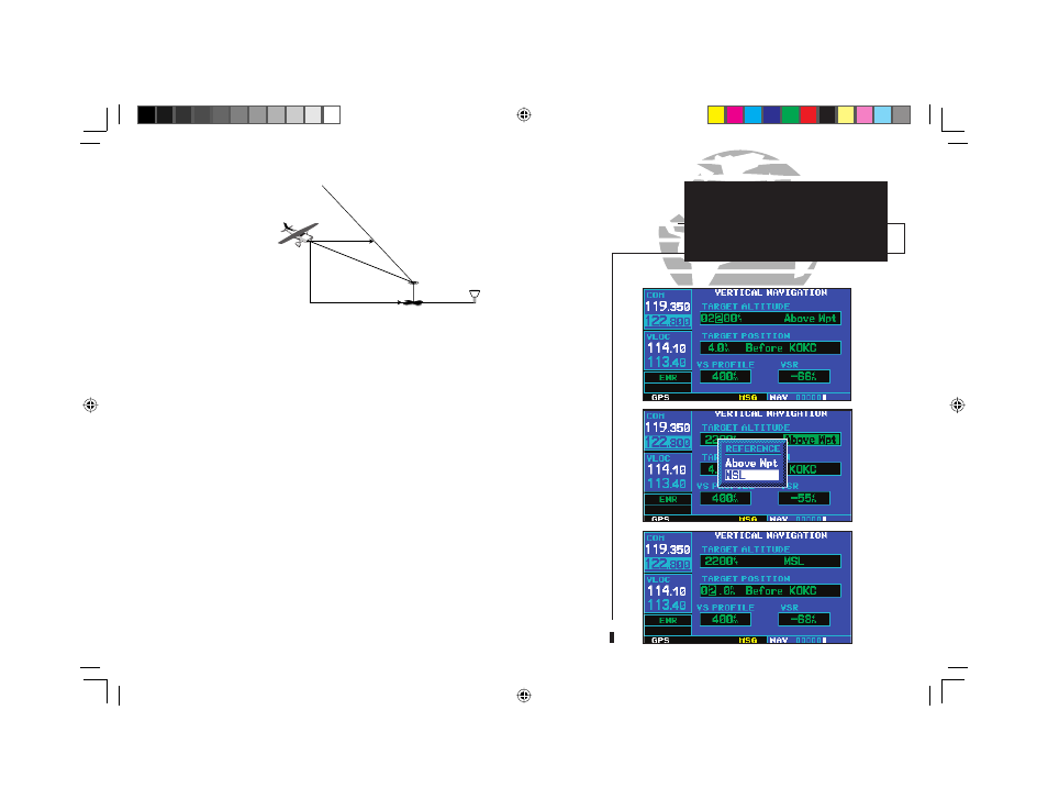
Vertical Navigation
(VNAV)
To create a vertical navigation profile:
1. Press the small right knob (
r
) to activate the cursor.
2. Rotate the large right knob (
d
) to highlight the target altitude field.
3. Rotate the small (
a
) and large (
d
) right knobs to select the target altitude and press
E
.
4. Rotate the small right knob (
a
) to select “Above Wpt” (AGL) or “MSL”, and press
E
.
“Above Wpt” will use the altitude of a destination airport as stored in the Jeppesen NavData
card. “MSL” lets you set a specific target altitude for any waypoint category: airport, VOR,
NDB, intersection or user waypoint.
5. Rotate the small (
a
) and large (
d
) right knobs to select a distance from the target reference
waypoint and press
E
. If the target altitude should occur at the target
reference waypoint, enter a distance of zero.
6. Rotate the small right knob (
a
) to select “Before” or “After”, and press
E
. This setting
designates whether the offset distance defines a point before you reach the target reference
waypoint or after you reach the waypoint.
7. When using a flight plan, the target reference waypoint itself can be specified from the
waypoints contained in the flight plan. By default, the last waypoint in the flight plan will be
selected. To select a different waypoint, rotate the small right knob (
a
) to select the desired
waypoint and press
E
.
{continued}
VERTICAL NAVIGATION PROFILE
VERTICAL SPEED REQUIRED
DISTANCE TO TARGET
TIME AND DISTANCE
TO PROFILE
TARGET ALTITUDE
AND POSITION
AIRPORT
CURRENT ALTITUDE
AND POSITION
r
q
o
p
190-00140-00.indd 47
5/7/2003, 5:16:45 PM