Takeoff tour – Garmin GNS 430 User Manual
Page 17
9
TAKEOFF TOUR
Map Page
The map page combines a moving map display
and navigation data for complete situational
awareness. Map setup pages are provided to
designate the maximum scale at which each
map feature will appear. These settings pro-
vide an automatic decluttering of the map
(based upon your preferences) as you adjust
the scale.
While viewing the map page, you can quickly
declutter and remove many of the background
map details by pressing the
c
key (repeat-
edly) until the desired detail is depicted.
To change the map scale, press the
ź or Ÿ
sides of the
R
key.
To change the standby VLOC frequency:
1. Press the small left knob (
v
), if needed, to activate the tuning cursor in the VLOC
window.
2. Rotate the large left knob (
h
) to select the MHz, and the small left knob (
a
) to select the
kHz of the desired frequency.
To place the standby frequency in the active field, press
V
.
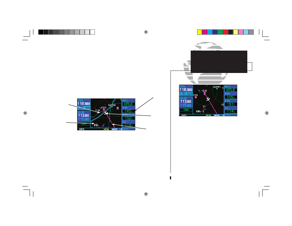
After the GNS 430 acquires satellites and computes a position, the map page will
appear automatically.
The map page displays your present position (using an airplane symbol) relative to
nearby airports, VORs, NDBs, intersections, user waypoints and airspace boundar-
ies—and your route displayed as a solid line. Data fi elds for destination waypoint (WPT),
distance to waypoint (DIS), desired track (DTK) and ground speed (GS) appear on the
right hand side of the display. These fi elds are user selectable (see page 37 for more
information) to allow you to confi gure the unit to your own preferences. Available settings
include: altitude, bearing, enroute safe altitude, estimated time of arrival, minimum safe
altitude, and ground track. See Section 10 for defi nitions of these navigation terms.
9
Data
Fields
Present
Position
Map Display
Map Scale
Map Page
Desired Track
190-00140-00.indd 9
5/7/2003, 5:16:12 PM