Remote elevation – Spectra Precision Survey Pro 3.80 Recon GPS Reference Manual User Manual
Page 62
GPS Reference Manual
62
Remote Elevation
6XUYH\ 5HPRWH (OHYDWLRQ
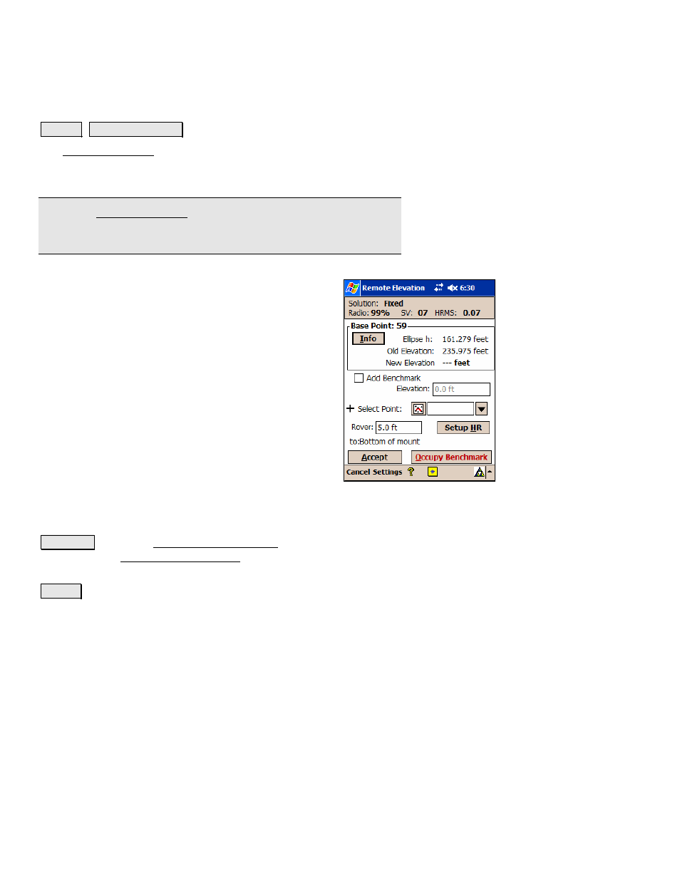
The Remote Elevation screen is used to compute and store a new base
point elevation and vertical site by occupying a known vertical
benchmark at the rover.
Note: The Remote Elevation screen is only available when a geoid
model is used for the vertical projection and the base and rover are
set.
Base Point
: displays the current base point number and
elevation details.
Info
: displays detailed information about the base point.
Add Benchmark Elevation
: When checked, a new point
will be created in the job file with the entered elevation.
If the horizontal projection is solved, we will calculate
(N,E) from the (lat,lng). If the horizontal projection is not
solved, we will store the new point at (0,0). In both cases,
the elevation of the new point will be that entered in the
Elevation
field.
Elevation
: When
Add Benchmark Elevation
is checked,
this is the elevation of the new point.
Select Point
/
New Point
: is the existing or new
benchmark point name that you will be occupying
depending on if the
Add Benchmark
box is checked or
unchecked, respectively.
Rover
: is where you enter the measured height of the rover antenna.
6HWXS +5 : opens the Rover Receiver Antenna screen, which is
identical to the Base Receiver Antenna screen discussed on Page R-29
where the details of the rover antenna are defined.
$FFHSW : Updates the projection with the vertical solution calculated
from the control point observation and updates the base point