Spectra Precision Survey Pro 3.80 Recon GPS Reference Manual User Manual
Page 57
Survey Menu – RTK
57
Solve Localization – Results
6XUYH\ 3URMHFWLRQ +RUL]RQWDO 6ROYH /RFDOL]DWLRQ 6ROYH ! or
0DQXDO (QWU\ ! or &DOFXODWRU !
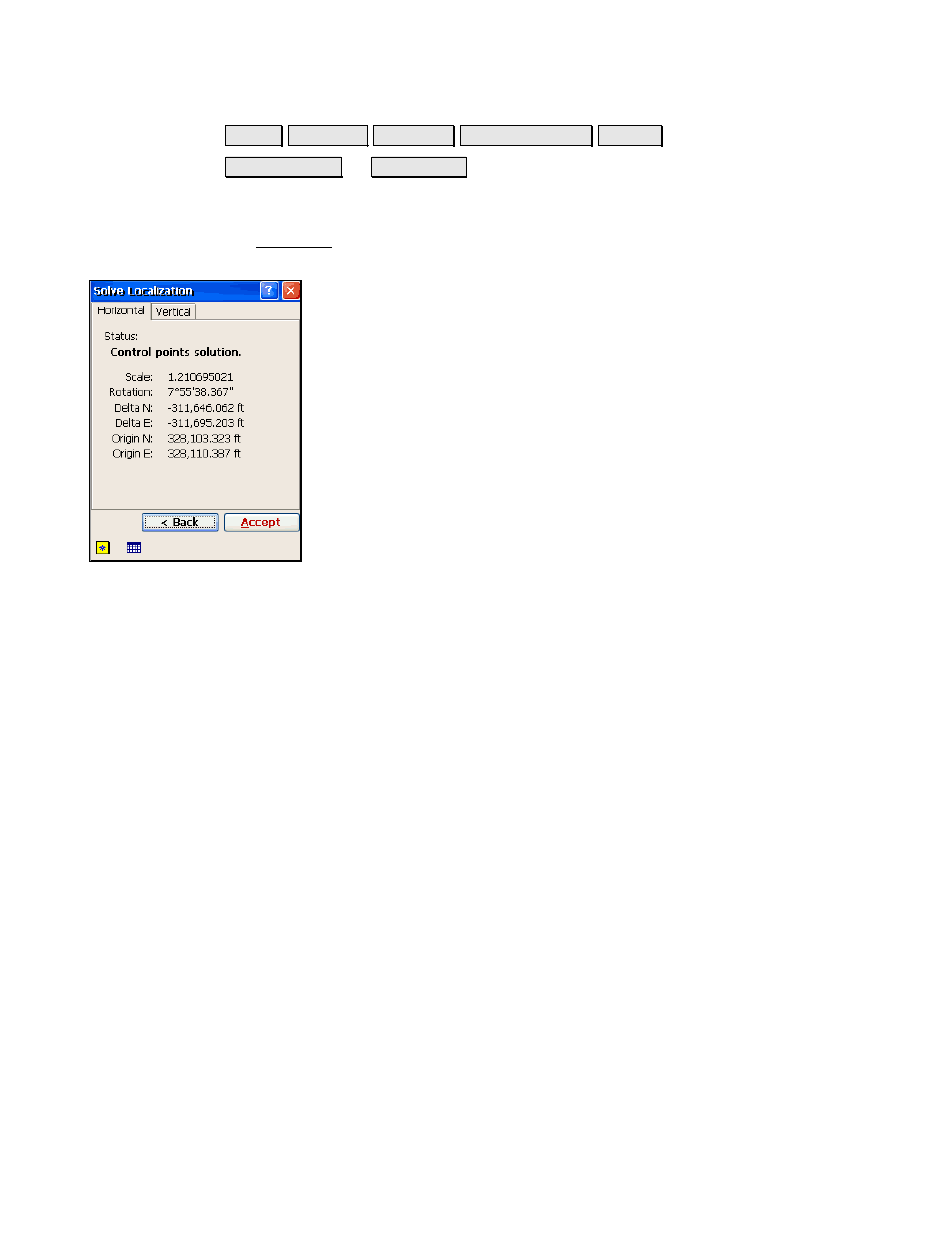
Horizontal Card
The Horizontal card shows results of the horizontal localization
solution.
Status
: displays the status of the current horizontal
solution. This will be one of the following:
•
Control points solution
: is displayed when the
parameters were calculated from the selected control
points.
•
Current horizontal site
: is displayed when there is a
horizontal solution and Solve H was not selected on
this pass.
•
No horizontal solution
is displayed when there is no
horizontal solution in
Ground- TDS Localization
mode.
This happens when you tap Solve H, and no control
points are selected.
•
Unadjusted Mapping Plane
: is displayed in
Mapping
Plane
mode when there is a mapping plane zone
selected, but no horizontal adjustment is solved.
Scale
: displays the scale factor.
Rotation
: displays the rotation.
Delta N
: displays the horizontal shift in north between the
intermediate map projection and the local coordinate system.
Delta E
: displays the horizontal shift in east between the
intermediate map projection and the local coordinate system.
Origin N
: displays the coordinate origin north of the localization
control points.
Origin E
: displays the coordinate origin east of the localization control
points.