System overview, Mfd softkeys – Garmin G1000 Piper PA-46 Meridian User Manual
Page 41
190-00763-01 Rev. A
Garmin G1000 Pilot’s Guide for the Piper PA-46 Meridian
27
SYSTEM OVERVIEW
SY
STEM
O
VER
VIEW
FLIGHT
INSTRUMENTS
EICAS
AUDIO P
ANEL
& CNS
FLIGHT
MANA
GEMENT
HAZARD
AV
OID
ANCE
AFCS
ADDITIONAL
FEA
TURES
APPENDICES
INDEX
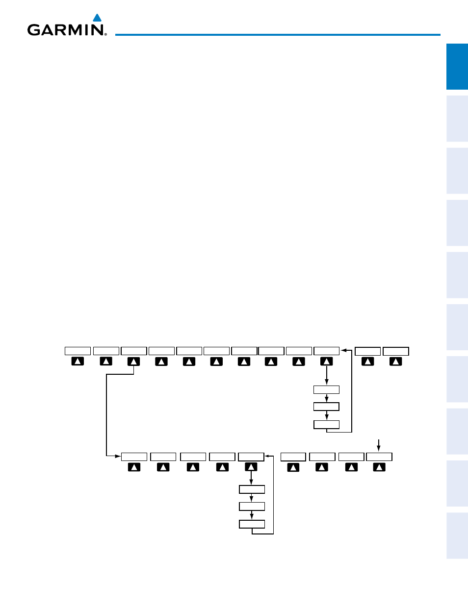
MFD SOFTKEYS
MAP
Enables second-level Navigation Map softkeys
TRAFFIC
Displays traffic information on Navigation Map
TOPO
Displays topographical data (e.g., coastlines, terrain, rivers, lakes) and elevation scale
on Navigation Map
TERRAIN
Displays terrain information on Navigation Map
AIRWAYS
(Default label is
dependent on map
setup option
selected)
Displays airways on the map; cycles through the following:
AIRWAYS: No airways are displayed
AIRWY ON: All airways are displayed
AIRWY LO: Only low altitude airways are displayed
AIRWY HI: Only high altitude airways are displayed
STRMSCP
Displays Stormscope information on Navigation Map (optional)
NEXRAD
Displays NEXRAD weather and coverage information on Navigation Map (optional)
XM LTNG
Displays XM lightning information on Navigation Map (optional)
BACK
Returns to top-level softkeys
DCLTR (3)
Selects desired amount of map detail; cycles through declutter levels:
DCLTR (No Declutter): All map features visible
DCLTR-1: Declutters land data
DCLTR-2: Declutters land and SUA data
DCLTR-3: Removes everything except for the active flight plan
SHW CHRT
When available, displays optional airport and terminal procedure charts
CHKLIST
When available, displays optional checklists
Figure 1-22 MFD Softkeys
MAP
DCLTR
TOPO
BACK
TERRAIN
DCLTR-2
DCLTR-3
DCLTR-1
Select the BACK Softkey
on this level to return to the
top softkey level.
NEXRAD
XM LTNG
SHW CHRT
CHKLIST
(optional)
AIRWAYS
AIRWY LO
AIRWAY HI
AIRWY ON
STRMSCP
TRAFFIC
(optional)