Hazard avoidance – Garmin G1000 Piper PA-46 Meridian User Manual
Page 366
Garmin G1000 Pilot’s Guide for the Piper PA-46 Meridian
190-00763-01 Rev. A
352
HAZARD AVOIDANCE
SY
STEM
O
VER
VIEW
FLIGHT
INSTRUMENTS
EICAS
AUDIO P
ANEL
& CNS
FLIGHT
MANA
GEMENT
HAZARD
AV
OID
ANCE
AFCS
ADDITIONAL FEA
TURES
APPENDICES
INDEX
Showing/hiding aviation information on the TERRAIN-SVS Page:
1)
Press the MENU Key.
2)
Select ‘Show Aviation Data’ or ‘Hide Aviation Data’ (choice dependent on current state) and press the ENT Key.
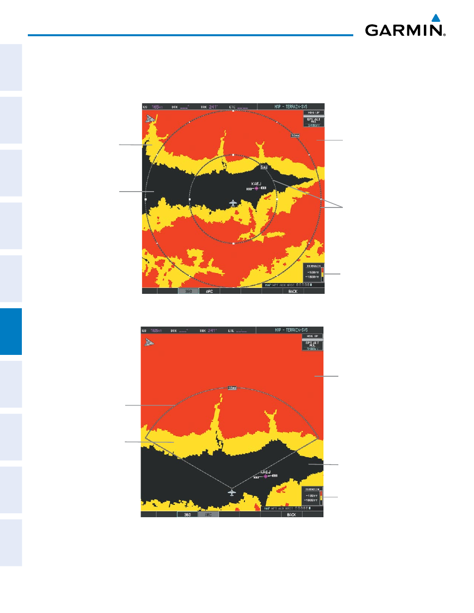
Figure 6-67 TERRAIN-SVS Page
Black Terrain
(Terrain More than
1000’ Below the
Aircraft Altitude)
Terrain Legend
Map Range Rings
Yellow Terrain
(Caution - Terrain
Between 100’ and
1000’ Below the
Aircraft Altitude)
Red Terrain
(Warning - Terrain
Above or Within
100’ Below the
Aircraft Altitude)
Figure 6-68 TERRAIN-SVS Page (ARC View)
Red Terrain
(Warning - Terrain
Above or Within
100’ Below the
Aircraft Altitude)
Black Terrain
(Terrain More than
1000’ Below the
Aircraft Altitude)
Terrain Legend
Map Range Arc
Yellow Terrain
(Caution - Terrain
Between 100’
and 1000’ Below
the Aircraft
Altitude)