Hazard avoidance, Xm lightning – Garmin G1000 Piper PA-46 Meridian User Manual
Page 322
Garmin G1000 Pilot’s Guide for the Piper PA-46 Meridian
190-00763-01 Rev. A
308
HAZARD AVOIDANCE
SY
STEM
O
VER
VIEW
FLIGHT
INSTRUMENTS
EICAS
AUDIO P
ANEL
& CNS
FLIGHT
MANA
GEMENT
HAZARD
AV
OID
ANCE
AFCS
ADDITIONAL FEA
TURES
APPENDICES
INDEX
XM LIGHTNING
NOTE:
XM Lightning and optional L-3 STORMSCOPE® WX-500 Lightning are mutually exclusive.
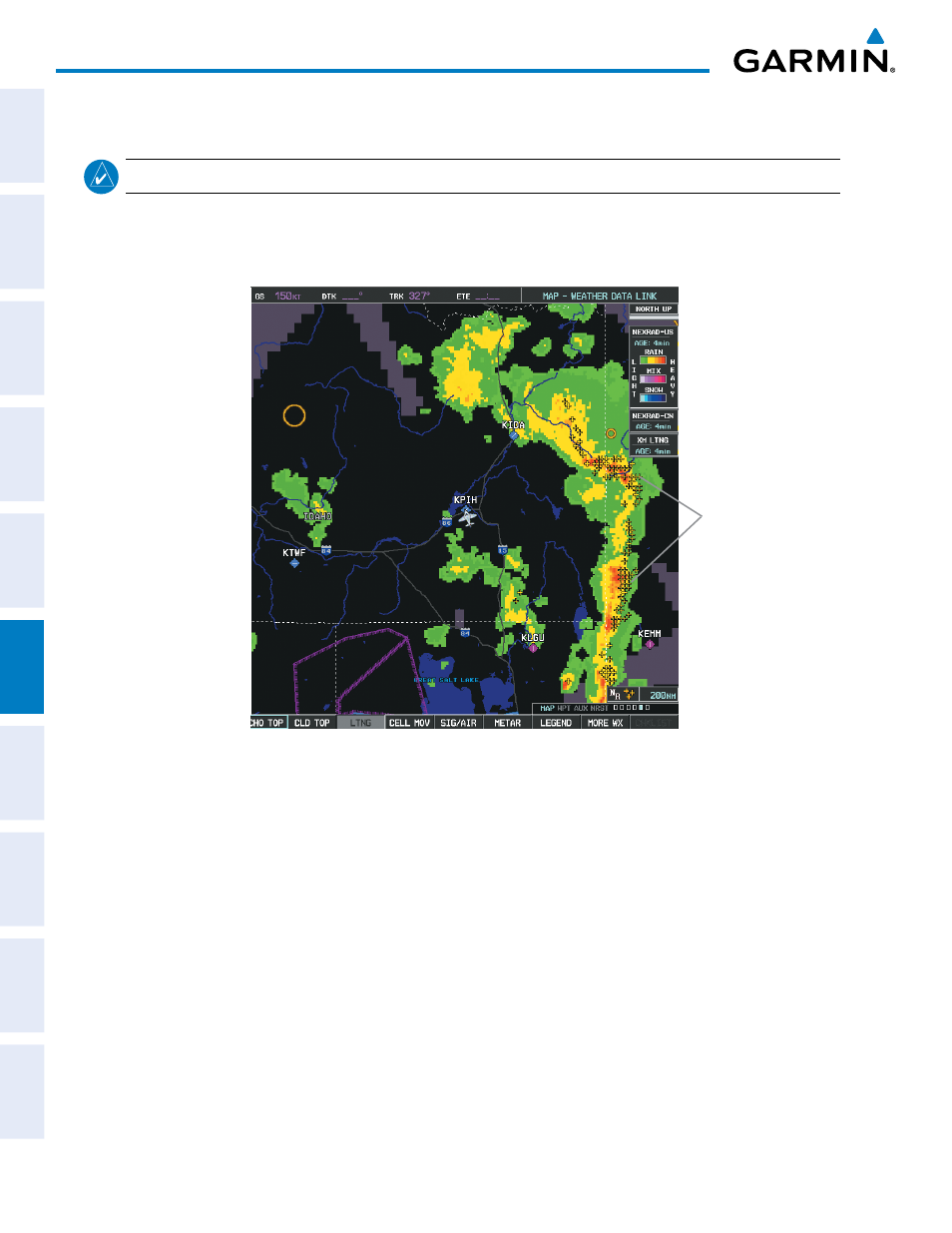
Lightning data shows the approximate location of cloud-to-ground lightning strikes. A strike icon represents
a strike that has occurred within a two-kilometer region. The exact location of the lightning strike is not
displayed.
Lightning
Strikes
Figure 6-17 Lightning Data
XM Lightning data displays on the following maps:
• PFD Inset Map
• Navigation Map Page
• Weather Data Link Page
• Trip Planning Page
• Nearest Pages
• Flight Plan Pages
Displaying XM Lightning information:
1)
Select the MAP Softkey (for the PFD Inset Map, select the INSET Softkey). This step is not necessary on the
Weather Data Link Page.
2)
Select the XM LTNG Softkey (LTNG Softkey on the Weather Data Link Page).
To display the XM Lightning legend on the Weather Data Link Page, select the LEGEND Softkey when XM
Lightning is selected for display.