TeeJet CenterLine User Guide v2.02 User Manual
Page 42
38 Chapter 3 - Operation
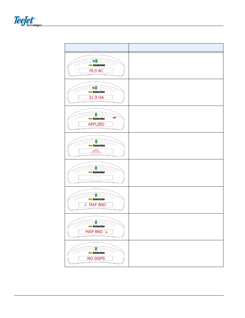
Area Applied. A user-defined lightbar message indicating the
current amount of area applied in acres. The system units are
set to US.
Area Applied. A user-defined lightbar message indicating the
current amount of area applied in hectares. The system units
are set to Metric.
Applied Area Detection. This message is displayed when the
vehicle is within a previously applied area. The red stoplight
(located on the far right) is illuminated.
Curved guidance information graphics. The four horizontal bars
in the text display represent a perspective view of the swath
ahead of the vehicle. The bars skew left or right to represent a
curved path ahead.
Curved guidance information graphics. The path in the text dis-
play represents a perspective view of the swath ahead of the
vehicle. The “hollow path” indicates that the vehicle is complet-
ing the first Headland pass and no guidance information cur-
rently exists. This is also displayed when in guidance mode but
the vehicle is not moving.
Mapping Boundary. This message is displayed when the user is
mapping the field boundary. The arrow symbol indicates the
field boundary is on the left side of the vehicle.
Mapping Boundary. This message is displayed when the user is
mapping the field boundary. The arrow symbol indicates the
field boundary is on the right side of the vehicle.
System Warning. This message is displayed when there is a
loss of differential GPS correction. Guidance calculations are
stopped until differential corrections resume.
Lightbar
Description