Db – starfire™ satellites, Figure 84: db – starfire satellites – NavCom StarUtil Rev.G User Manual
Page 89
StarUtil User Guide – Rev. G
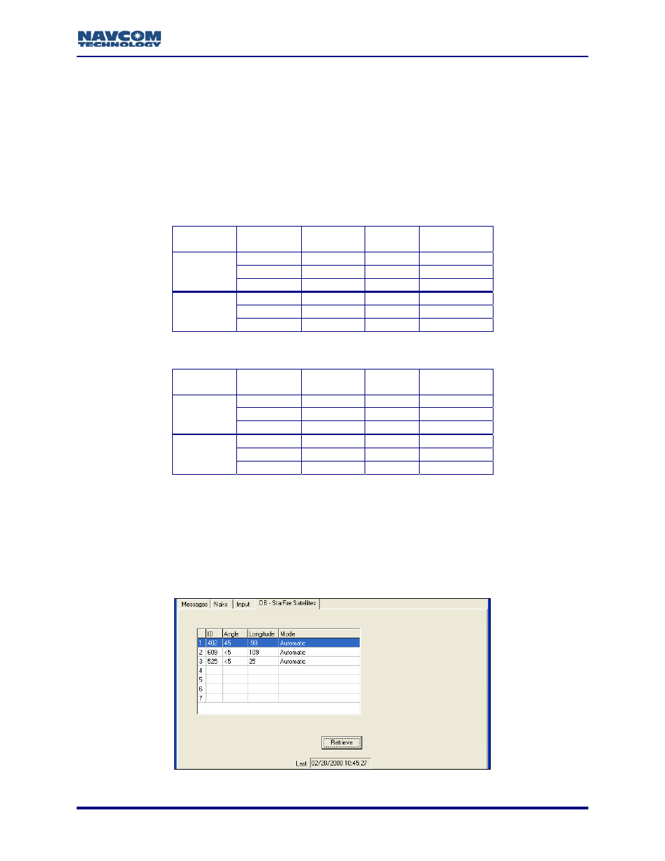
DB – StarFire™ Satellites
hased by the user. The tables below identify StarFire
™ Satellites by
satellite if it is
details on the user-defined satellite.
.26 and Earlier
Satellite
Name
Uplink Site
The DB-StarFire
™
Satellites tab provides a list of the licensed StarFire
™ Satellites in the
StarFire
™ Network(s) purc
Network.
In addition, the DB-StarFire
™
Satellites tab lists the licensed user-defined
efined. It is the seventh satellite in the list.
d
Refer to the section, Define Satellite, in Chapter 6 for
Table 6: StarFire™ Satellites – Software v4.2
Network Satellite
ID
Longitude
402 98W
PAC-E
Laurentides
609 109E
IND-E
Perth
Net
25E IND-W
Burum
1
525
358 142W
PAC-C
Santa
Paula
643 143.5E
PAC-W
Auckland
Net 2
484 15.5W
AOR-E
Southbury
Table 7: StarFire™ Satellites – Software v5.1.6 and Later
Network Satellite
ID
Longitude
Satellite
Name
Uplink Site
402 97.65W
PAC-E
Laurentides
609 109E
IND-E
Perth
Net 1
525 25E IND-W
Burum
358 142W
PAC-C
Santa
Paula
678 178E
POR
Auckland
Net 2
484 15.5W
AOR-E
Southbury
The Longitude 178E (POR) is tentatively set to change to 143.5E (PAC-W) on
May 13, 2009. The Satellite ID will also change from 678 to 643.
9
Click the Retrieve button to view the current list of licensed StarFire
™ satellites, and the
user-defined satellite (if defined).
•
Mode: Displays Automatic to indicate that the receiver is set to automatically select the
highest li
to indicate that the
satellite
censed available satellite from the list. Displays Manual
in use is manually selected.
Figure 84: DB – StarFire Satellites
6-87